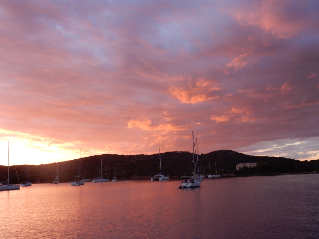
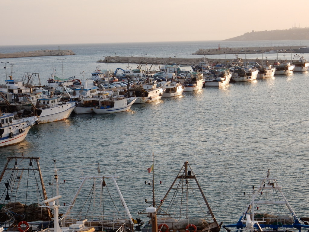
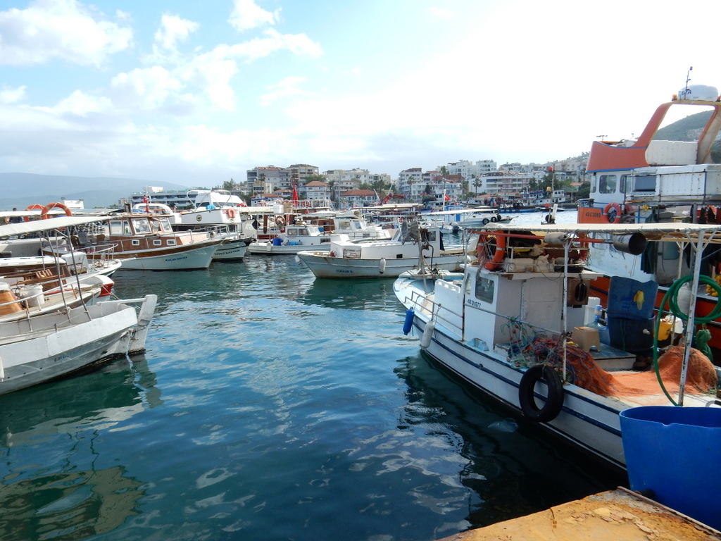
Fishing boat returns to port (Carloforte). Sardinia is in the background.
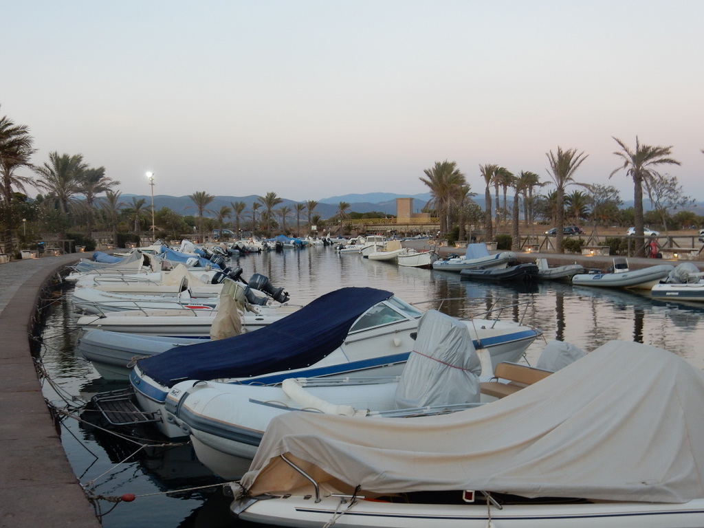
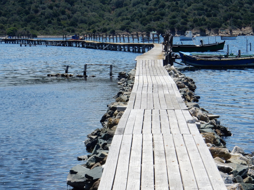
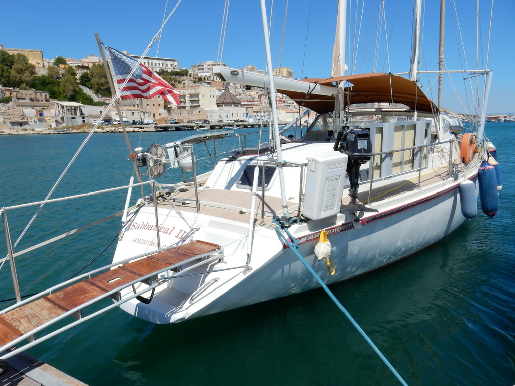
In all past years, the end of season blog contains a photo of Sabbatical III in the slings of a “Travellift” as she is being placed on a hardstand ashore for her winter rest. Not this year. Sabbatical III will spend the winter season in the water as there is no boat storage ashore in Carloforte. It is a first for us.
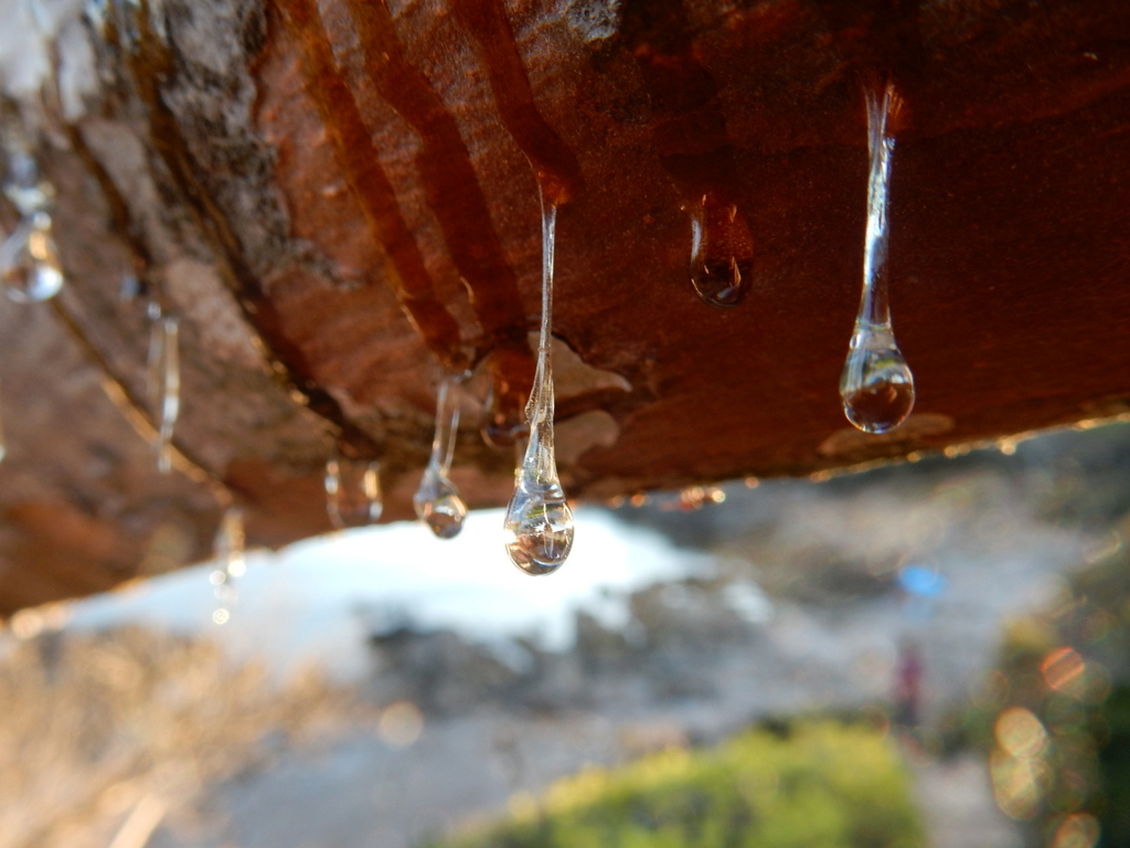
We spent the last days of October and early November doing boat maintenance and getting her prepared for storage afloat. Since easterly storms can bring sizable swells into the Marine Sifredi, we added large stainless steel springs to the two aft lines that hold the boat to the breakwater. On one end, these springs are connected to lengths of chain that go around large bollards ashore. On the other end, we have new lines with steel eye thimbles that connect to the springs with large shackles. In case a spring should break, a length of chain is shackled from the eye thimble to the chain around the bollard. This way the boat floats somewhat freely and does take the full impact of shock loads from rough seas that would otherwise occur if she were tied tightly to shore.
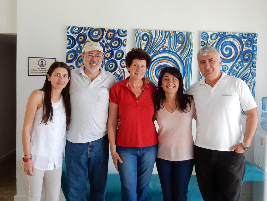
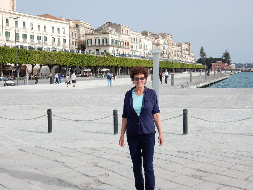
Laura poses with David of the Napitia gelato shop on the last day of the season
After November 1, the ferry schedule to Carloforte was drastically reduced as were the the number of daytripper tourists to Carloforte. Most restaurants closed down and by early November not a single gelato shop was in operation. The last to close was our favorite place Napitia, just across the street from the marina.
In early November the whole island came out for a free concert by Gianni Morandi who has been a famous pop singer, actor, and TV personality in Italy for fifty years. A film crew spent some weeks in Carloforte making a movie staring Gianni Morandi and using townfolk as extras, and the concert was Morandi’s way of saying thank you. He performed on a stage set up on the waterfront and the crowd loved it.
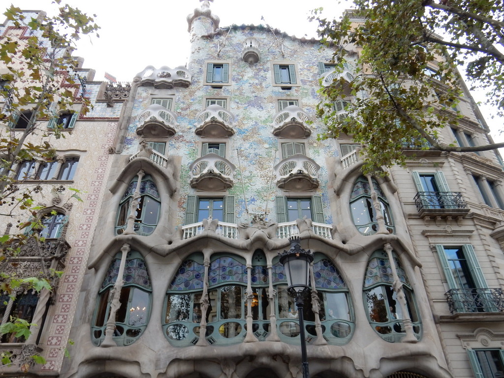
In the first week of November, we took a respite from our labors and hopped a super cheap flight from Cagliari to Barcelona where we stayed in a comfortable hostel. We loved the city. We walked miles through its beautiful streets taking in the sites, people watching, and tasting Catalan cuisine.
Inside Sagrada FamÃlia (Barcelona)Outside Sagrada FamÃlia (Barcelona). The face is that of Gaudi the architect.Sagrada FamÃlia (Barcelona)Sagrada FamÃlia (Barcelona)Large numbers of Chinese tourists visit Barcelona and Sagrada FamÃlia
We were particularly taken with Gaudi’s yet unfinished masterpiece, the Sagrada FamÃlia cathedral (above) and the Casa Batlló.
Casa Batlló, modernist house designed by GaudiCasa Batlló, modernist house designed by GaudiChurros with hot chocolate and cream (Barcelona)
On a rainy day, we took the train to Girona where a thriving Jewish community distinguished by its Kabbalah scholars existed prior to the Inquisition.
Memorial to Ramban (Rabbi Moses ben Nahman) in Girona, SpainLaura poses in the old Jewish Ghetto of GironaThe cathedral in Girona is directly adjacent to the old Jewish Ghetto
On our way back to the US, we spent two and one-half days in the lake country north of Milan. We stayed at a small hotel on the Sacred Mountain of Varese overlooking Lake Varese in the Campo dei Fiori National Park. It was on an impossibly steep and narrow road but well worth the effort. From there we drove to the Malpensa Airport for a flight to Miami.
While home, we will organize our best photos and video for our web site. We will post when that task in complete.
M.
View from near our hotel on the Sacred Mountain of Varese, ItalyView towards the Sacred Mountain of Varese, Italy
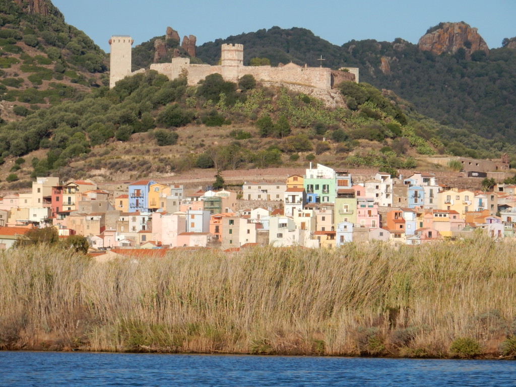
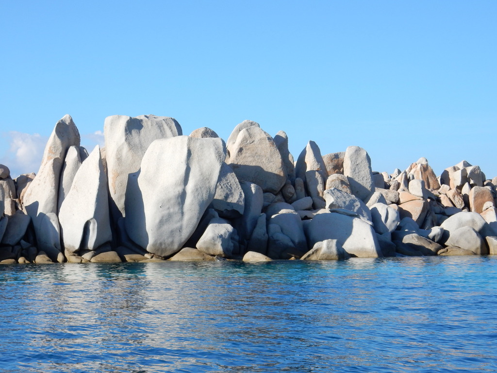
View of the river city of Bosa (Sardinia) as we come up the River Temo in our dinghy. The Malaspina Castle overlooks the city.
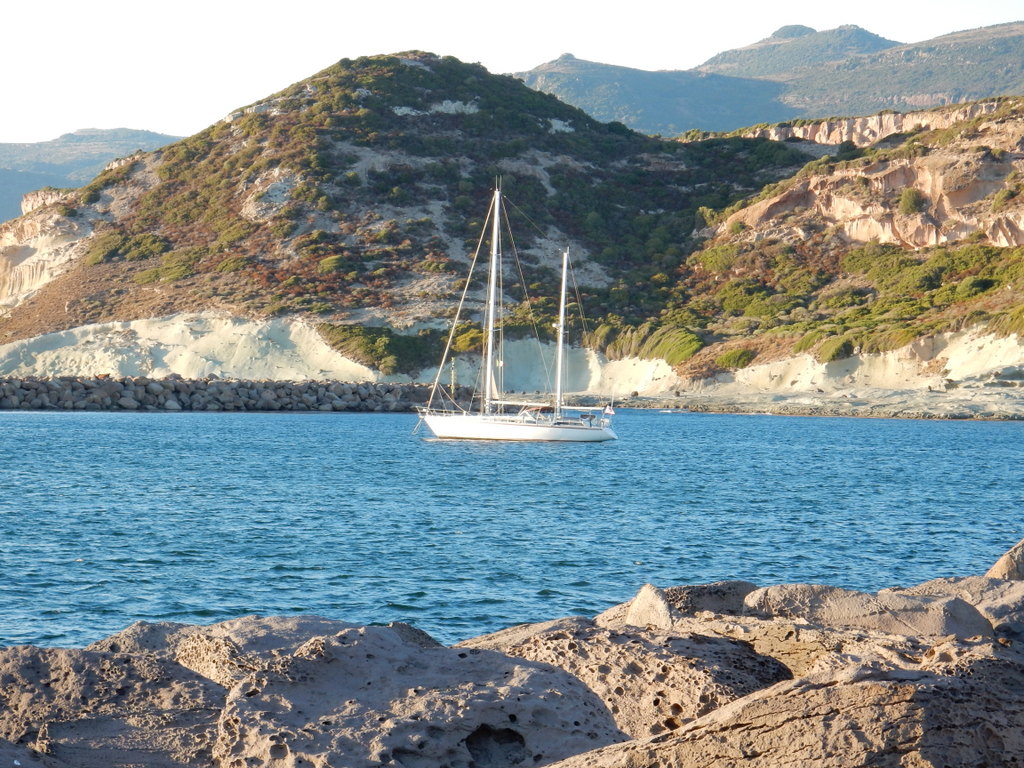
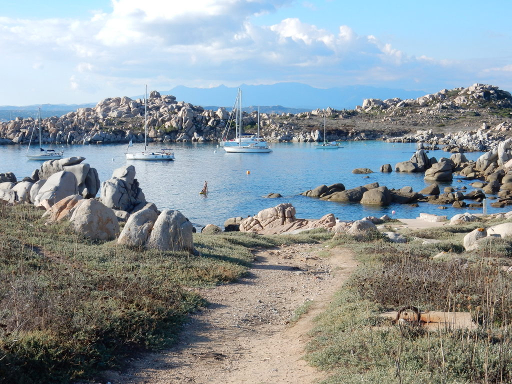
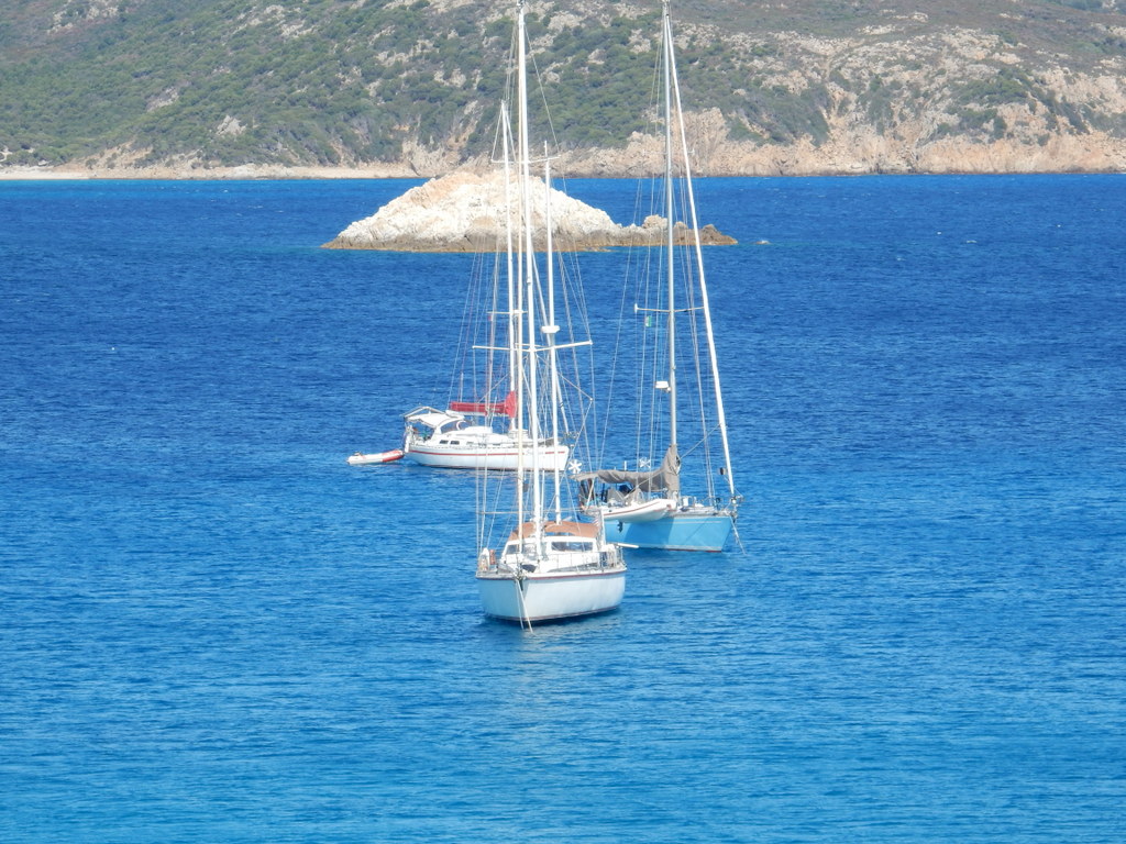
After a night at Lavezzi Island on the French side of Bonifacio Strait, we crossed the Strait to the “La Colba†anchorage on the south side of Capo Testa, Sardinia on September 27th. Overnight the winds shifted to easterlies and built during the next day to 25 + knots. We did not leave La Colba especially early since we knew that with this wind we would have little trouble arriving at our anchorage on the northeast side of the Fornelli passage, at the far northwest tip of Sardinia, before sunset. As we neared the Fornelli Passage we were concerned by how the seas had built up and were funneling into the Passage. As we approached our primary and secondary anchorage locations, we could see that they were untenable in these seas but that there was still plenty of light to navigate the Fornelli Passage itself and look for a place to anchor behind Isola Piana on its more protected western side. Unfortunately, there was nothing but rocks on the western side of Isola Piano and there were breaking waves to its south. There was still plenty of daylight left so we turned the corner and headed south along the wild west coast of Sardinia to look for a place to anchor for the night. Our pilot book did not list an anchorage closer than Porto Conte which, at 30 miles away, was and too far to sail to before dark even in the great winds we were experiencing.
A quick study of the charts and a Google search suggested that Cala Santa Nicola, about 15 miles away, would likely provide protection from the strong north-easterlies, although there was some doubt about the suitability of the sea bottom to hold an anchor. The small bay was almost uncharted and supposedly had a dangerous rock in the middle, so we inched our way along the northern shore. We had to come in fairly close to get protection from the swell but Laura could only see a solid rock bottom from her perch at the bow. We dropped anchor anyway and sure enough, it was a solid rock bottom. The anchor just skittered along the bottom, having nothing to grab onto. We tried again even closer to the sandy beach and had the same result. There was nothing to do but head to Porto Conte. We had lost 45 minutes with our deviation to Cala Santa Nicola and even though we could sail 7.5 – 8.5 knots in the strong north-easterlies, it would be dark by the time we arrived at Porto Conte.
We almost never arrive at an anchorage in the dark. In this part of the world, one really needs to see the bottom. If you drop in sea grass, you may think your anchor is holding but it probably won’t, especially in strong and shifting wind. We had been to Porto Conte in July and had to spend some time looking around for a patch of sand in Calla del Bollo at the southern end of the bay. Based upon that experience, we definitely did not want to anchor in the same place in the dark. Some months before, Michael and Britta of “Vera” had supplied us with a waypoint for a place to anchor in Cala Torre del Conte, in the northwest corner of this large bay. We decided to head for that waypoint. We arrived in total darkness and blindly dropped anchor. The anchor seemed to hold and we settled in for a late supper and sleep. It had been a long day and our passage was twice as long as what he had planned. The next morning Laura went for a swim with snorkel and goggles and found that our anchor was in the only patch of sand in a bottom of sea grass.
Later that morning (September 29), we sailed over to Marina di Sant Elmo in the city of Alghero. We had stayed in this marina for two nights in July and found it comfortable and had really enjoyed walking around Alghero. This time we spent five days in Alghero and enjoyed this old Spanish walled city as much as we had in July. The weather was fine as we walked in the narrow streets and along the city walls and found some great restaurants. The tourist crowd was gone and we did not need reservations to eat anywhere we wished. We also found a marine canvas guy who fixed our damaged bimini.
The walled city of Alghero (Sardinia) as seen from the seaView of Villa Las Tronas and Alghero
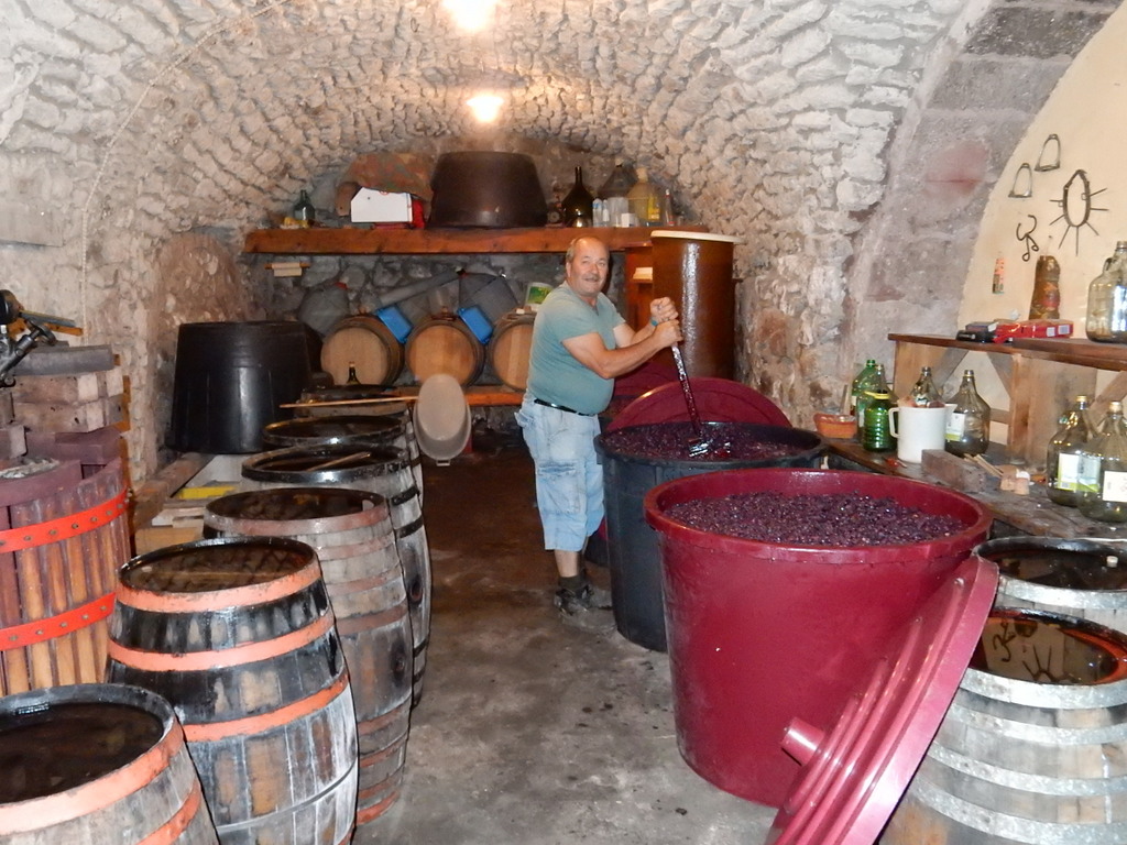
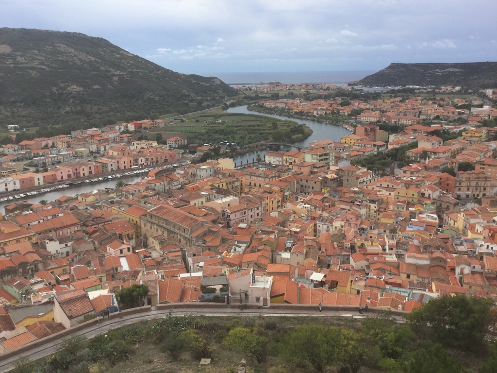
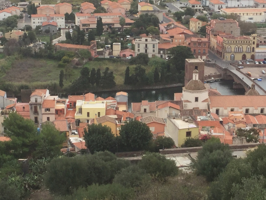
We left Alghero on October 4 and sailed south to the mouth of the River Temo and anchored behind a new breakwater built to make the entrance to the only navigatable river in Sardinia safe from breaking seas. A bit more than 2 kilometers up the river is the charming town of Bosa. We took the dinghy up the river and tied up at at open spot next to a fishing boat on the quai on the river. We were confident that this spot was vacant since its previous inhabitant was clearly visible, sunken on the river bottom below us and still tied to a bollard.
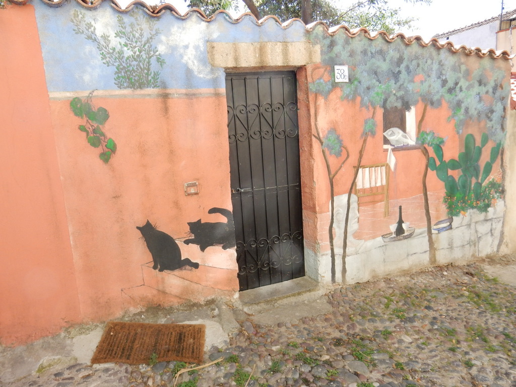
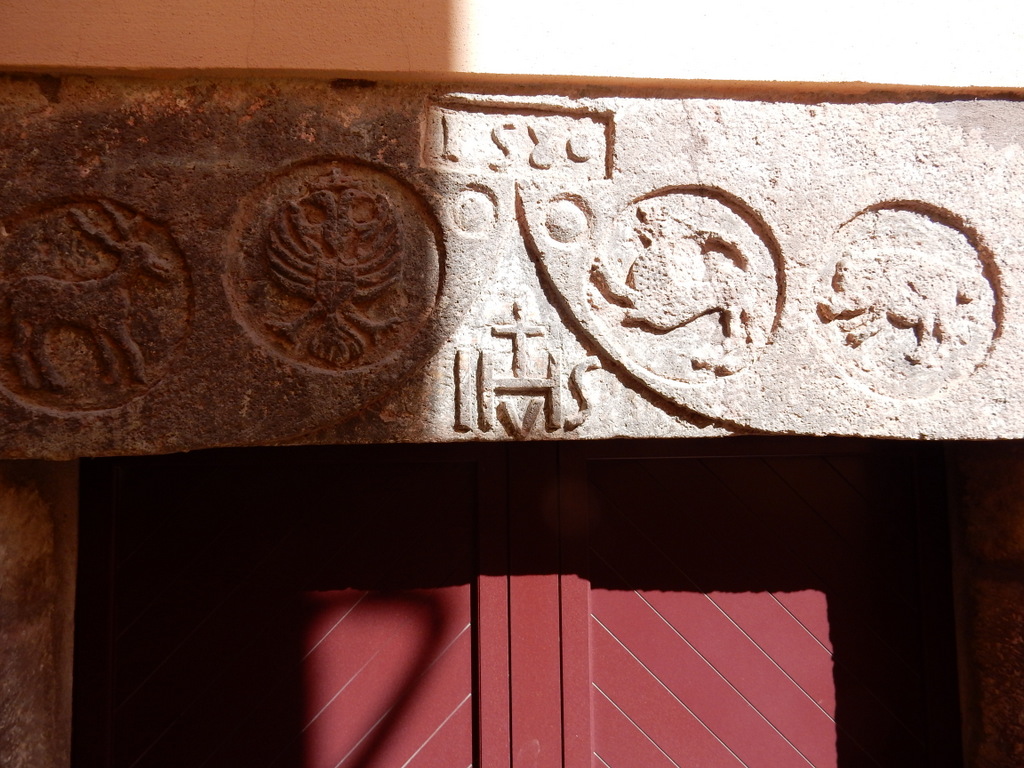
Our dinghy tied up to the quai in the river town of BosaBuildings in Bosa are in lively colors, often have wrought iron balconies, and decorated entrances. These are the grander buildings along the riverfront.We peered into a door in an alley in Bosa and found this guy stirring the wine vatsSabbatical III at anchor in the mouth of the River Temo“Sand crab” on the beach near BosaWe loved our meal at this locanda on a cute little piazza in BosaThe street leading to the locanda in BosaDecorated entrance to a house in BosaDecorated entrance to a house in BosaDecorated entrance to a house in BosaDecorated entrance to a house in BosaLintel for this house says 1580 (Bosa)View of BosaBosa from Malaspina CastleBosa from Malaspina CastleMany homes in Bosa purposely have gaps in the exterior stucco in order to reveal the original stone work
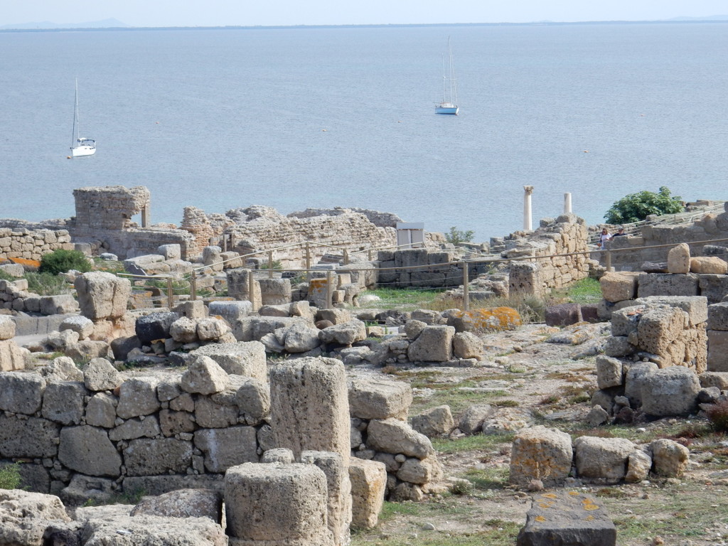
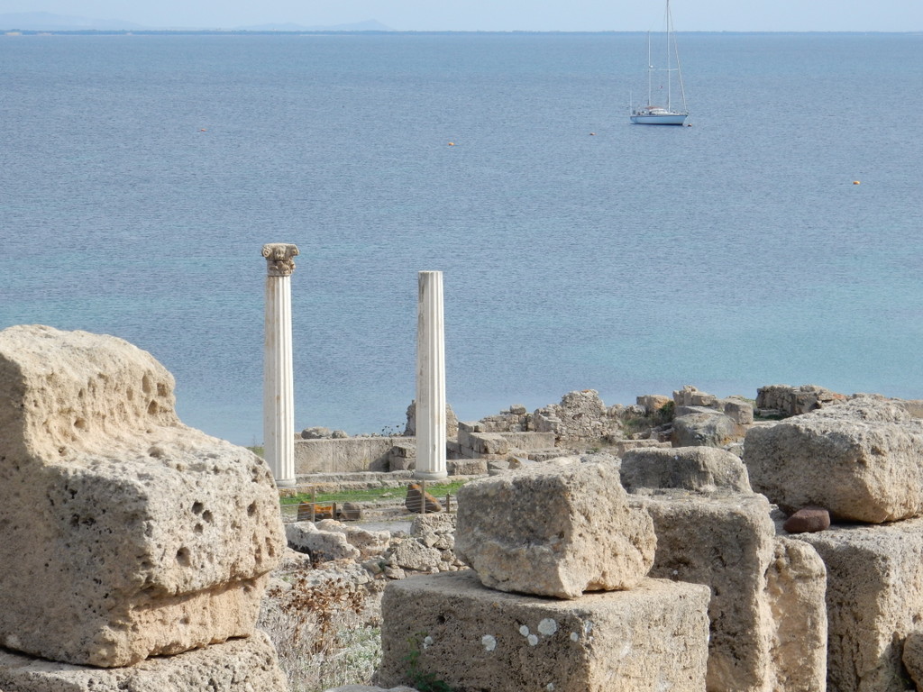
We spent five days in Bosa before sailing 29 nautical miles south to Oristano where we picked up a mooring in front of the ruins of the ancient city of Tharros on the Sinis peninsula. Tharros was established by the Nuragic people of Sardinia in the Bronze Age and became an important Phoenician outpost in the 8th century BC. It subsequently became a Punic (Carthage) city and a Roman city before being abandoned in the face of Saracen attacks in the early Christian period.
Ancient city of Tharros (Sabbatical III in background)Ancient city of Tharros (Sabbatical III in background)
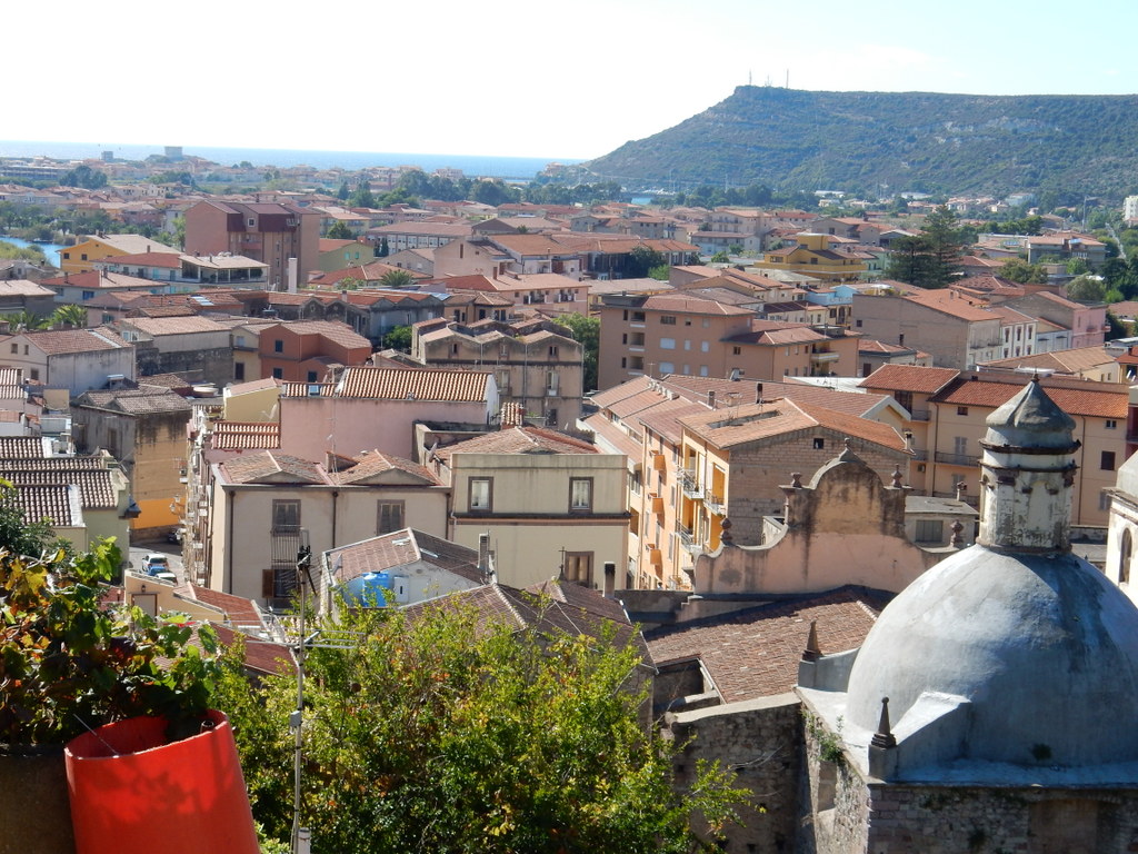
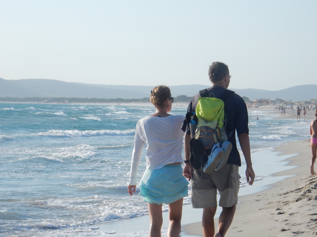
After one day in Oristano, on October 10 we sailed 45 nautical miles to Carloforte in ugly seas with large, steep waves from the northwest. We are still in Carloforte enjoying this town even more now that most of the tourists are gone. We are spending a few hours every day doing the boat maintenance and repair required after a long sailing season that began in southern Turkey.
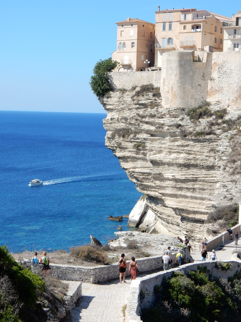
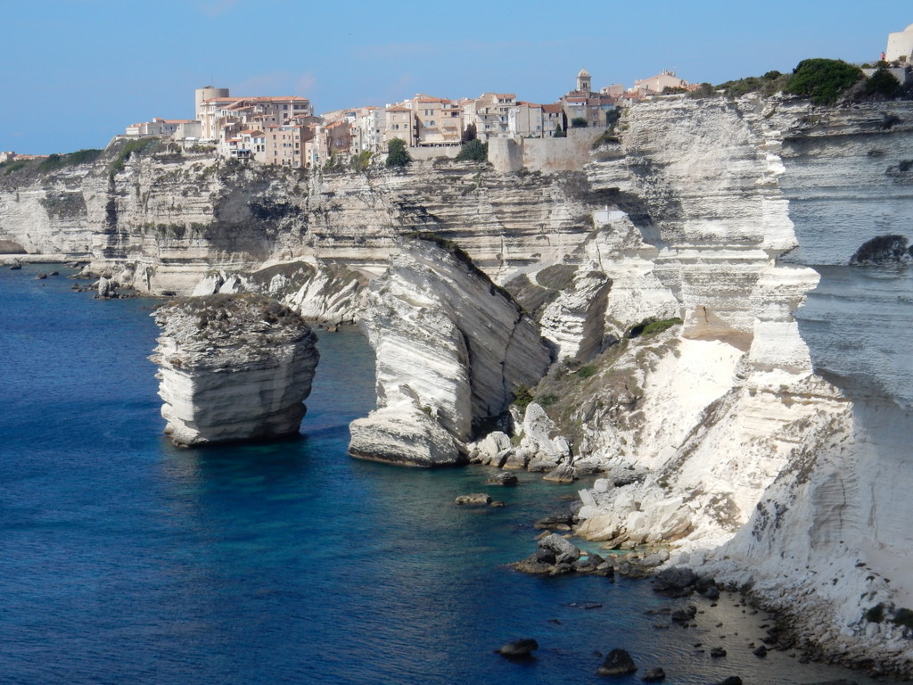
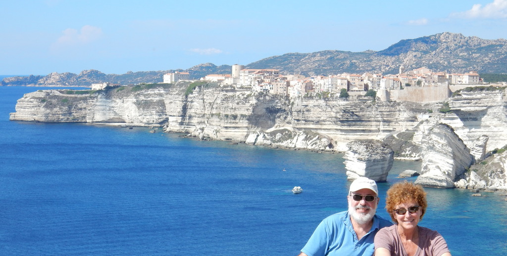
View of the citadel at Bonifacio, Corsica (France)
We left Porto Vecchio, Corsica on September 19th and sailed south along the east coast before anchoring in the Golfe di Rondinara, a popular and very pretty and protected bay about 15 sailing miles away. It was a beautiful sunny day with lots of wind. Rondinara has lots of sea grass so there was not much room to drop anchor in sand, and even the sand that was available is thin and offers poor holding. In the hours after we anchored, many other boats squeezed into the bay, often getting too close to boats that were already at anchor. That made me nervous, particularly since a charter boat whacked Sabbatical III in Porto Pino by anchoring too close just one week before. As it were, a large power yacht in front of us hit another power yacht while both were at anchor and swinging in the wind and they got entangled, leading to a lot of shouting and rushed activity. As the offending yacht re-anchored alongside Sabbatical III, I stood on deck with my hands on my hips and stared at him just to let him know of my concerns. Hopefully, my actions persuaded him to stay a few meters further from me than he otherwise would have. Nonetheless, the crowd made us nervous all night and we left first thing in the morning.
I checked the charts looking for someplace less popular with lots of space even if it was not as well protected. The large bay at Santa’Manza fit the bill perfectly. It was wide open to the northeast quadrant but there was only one other vessel at anchor when we arrived, and he soon left, and we could tell that as long as we paid attention to wind direction and were willing to put up with some swell from the strong wind, we could anchor in peace and security. Ashore, there was a beach bar that was only open on the weekend, and the small hamlet of Santa’Manza – so small that it lacked basics such as a bakery or any type of store, and bus service. However, the small Hotel du Golfe was open along with the hotel restaurant. What a gem it turned out to be. We ate at the hotel restaurant every day and in the late afternoon sat on their patio overlooking the bay and drank Pastis while using their WiFi. There was a beautiful walk along the north side of the bay with small sandy beaches interspersed with rocky shore.
The bay at Santa’Manza in southeastern Corsica where we anchored for five daysView of the citadel at Bonifacio, Corsica (France)
Our plan was to spend a couple of nights in Santa’Manza, waiting for the wind to settle down, and then sail around to the famous city of Bonifacio, set on the white chalk cliffs of the Bonifacio Strait, where we would have to stay in a pricey marina. As we walked along the bay after lunch at the Hotel du Golfe on our first day, our waiter, Silvio, drove by and asked if we needed a ride. He was going to Bonifacio. So we hopped into his car and 15 minutes later we at the citadel of Bonifacio, a high promontory overlooking the Straits. It is such an impressive place. A walled city dating to the 9th century sitting on a narrow peninsular high over the Mediterranean. There is a very narrow fjord that cuts through sheer chalk cliffs and into the small port. While there we noticed that the marina was full, probably because boats were waiting for the wind to calm before heading out into the Bonafacio Strait, considered the windiest place in the Mediterranean. Both Silvio and the proprietress of the Hotel du Golfe said that if we wanted a ride to Bonifacio from Santa’Manza on another day, we should just stand on the side of the road with our thumb out and a local would take us. It was true. Because of that we kept the boat at anchor in quiet Santa’Manza and hitched into Bonaficio. There were only a few hours of uncomfortable roll at anchor during the five days we were there.
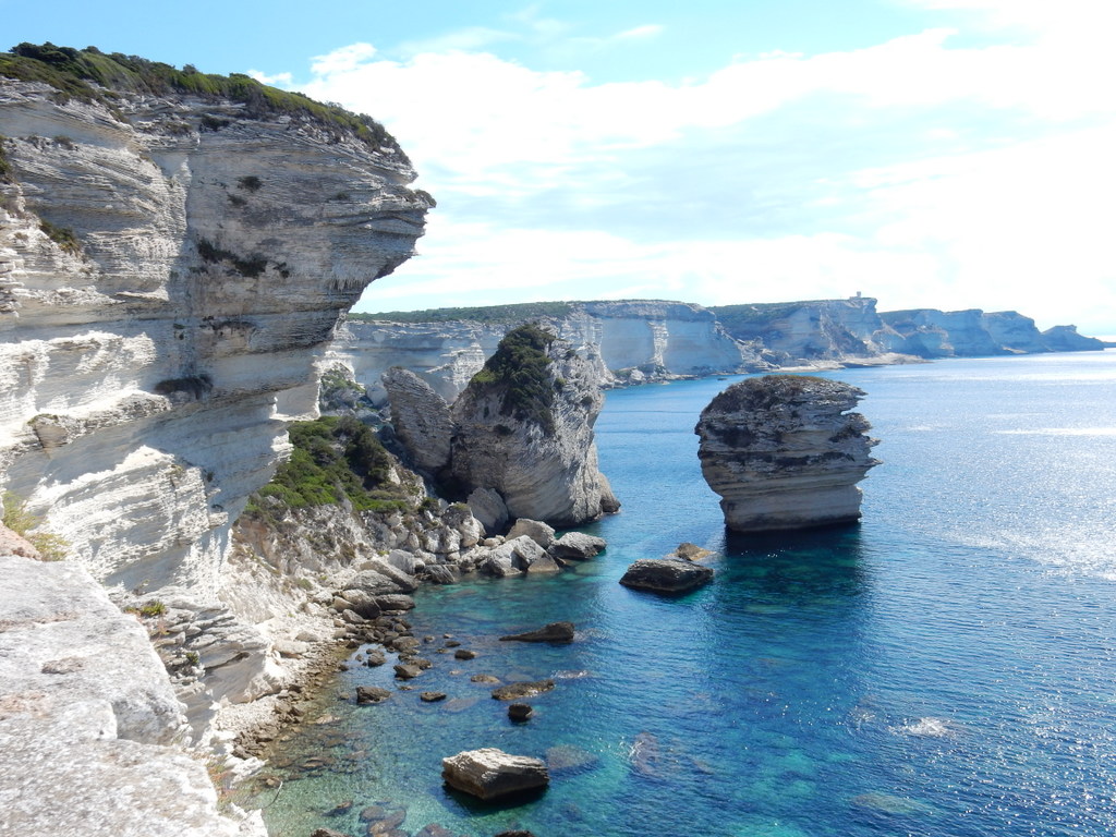
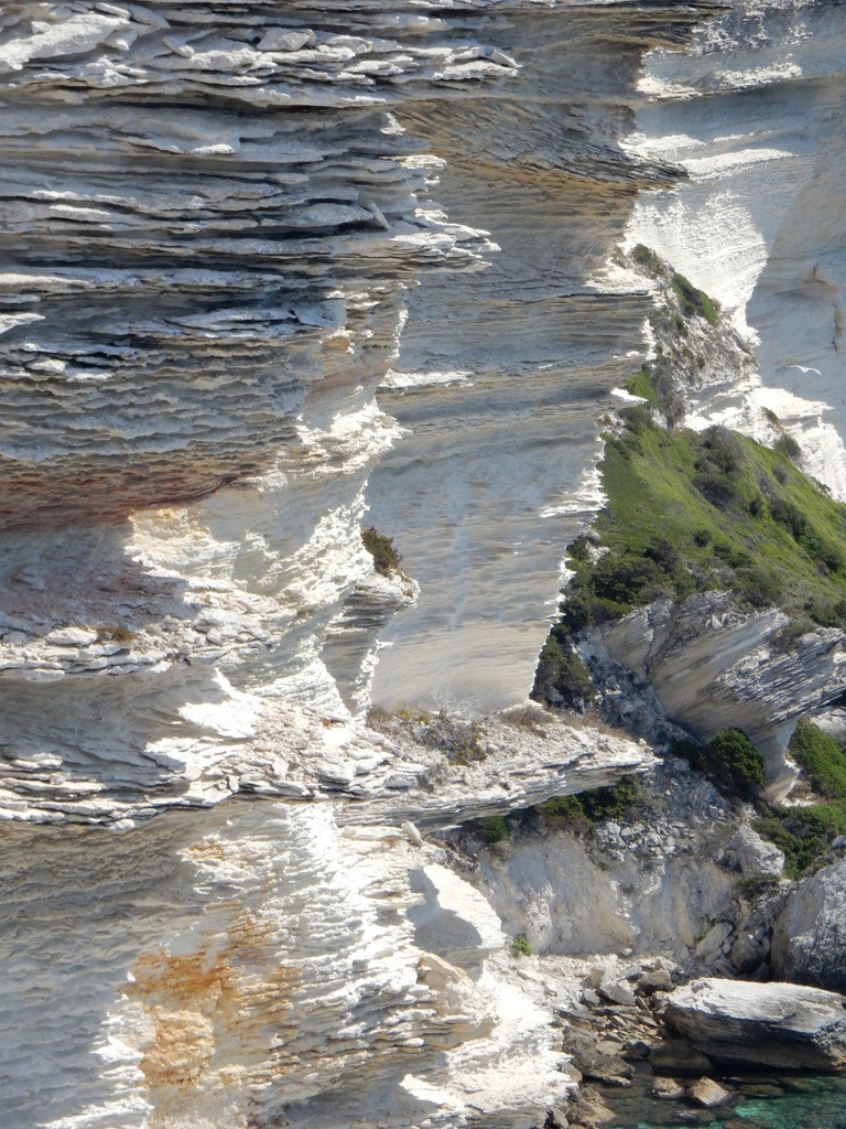
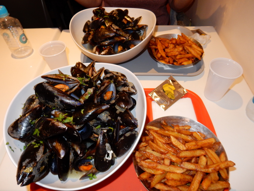
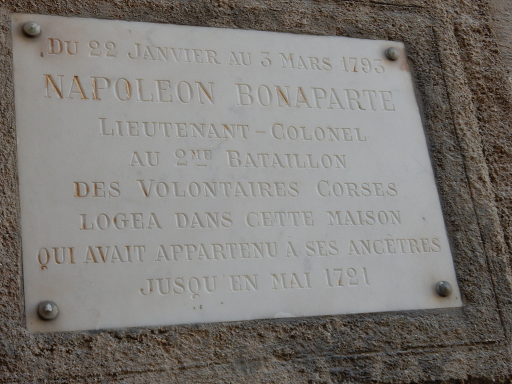
View of the cliffs east of Bonifacio at the southern tip of CorsicaThe chalk cliffs at Bonifacio are not made of the most solid stuffView of the cliffs east of Bonifacio at the southern tip of CorsicaWe hiked a beautiful trail that runs on the edge of the cliffs east of BonafacioEvery restaurant in Bonifacio offers the dish for which this place is famous – moules frites (mussels steamed in garlic and spices, served with fries)Corsica’s most famous son, Napoleon Bonaparte, spent part of this early military career in Bonifacio
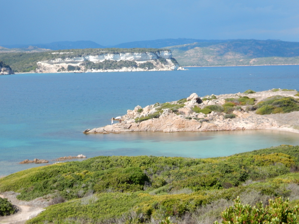
The wind calmed to nearly nothing so we decided to visit the uninhabited French island of Lavezzi in the Bonifacio Strait, the southernmost part of Metropolitan France, on our way back to Sardinia. It is a very pretty place but hard to enter and leave without local knowledge. After a night at Lavezzi, we crossed the Bonifacio Strait to the “La Colba†anchorage on the south side of Capo Testa, Sardinia. We will describe more of our trip back from Corsica in our next blog entry.
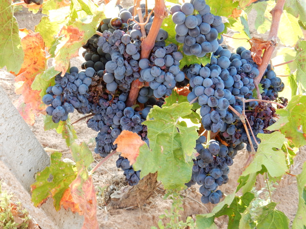
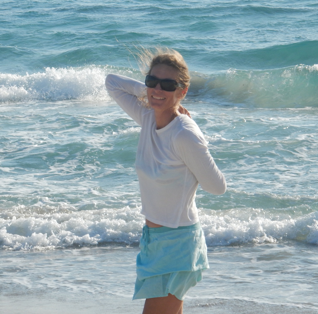
Laura poses with wine grapes on the path above Cala dei Francesi, Sardinia
We left Porto Pino, Sardinia on September 11, heading for Porto Vecchio, Corsica. On the way we stopped for one night each at Malfitano, Capo Carbonara, and Arbatax. We then sailed overnight from Arbatax to Porto Novo, Corsica arriving early on the morning of 15 September. We spent the night at this quiet anchorage before heading into the marina at Porto Vecchio the next morning. Porto Vecchio is a cute town on a hill at the end of a long fjord-like bay that funnels the wind like crazy. The marina leaves much to be desired but when it is blowing over 30 knots consistently, it good to be able to get off the boat and walk around and sample French and Corsican cuisine.
We had dolphins visit Sabbatical III about 20 miles north of Arbatax. Here is a short video of their visit:
M.
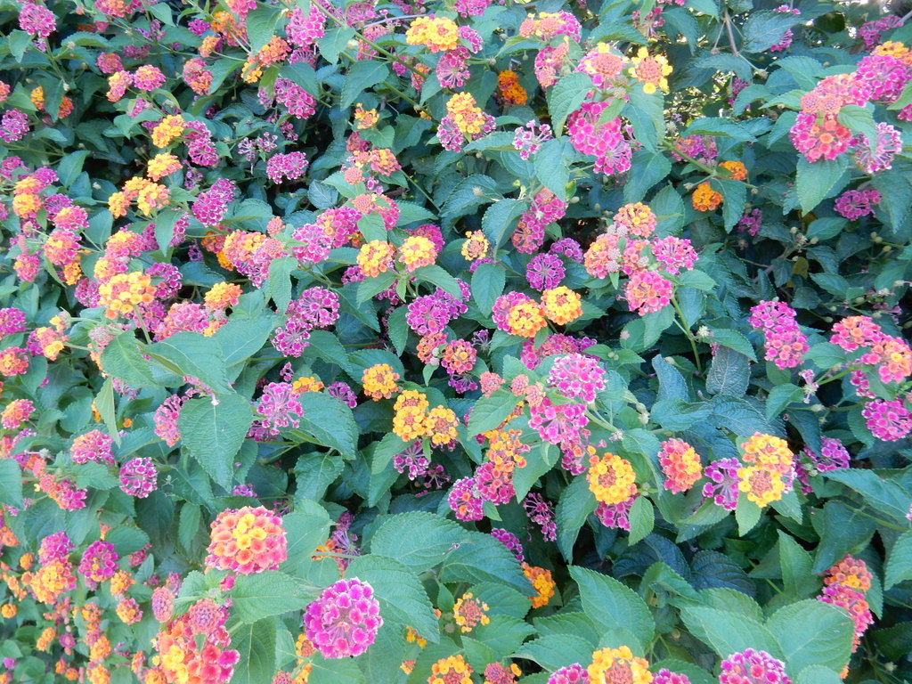
Sunset over the Golfo di Palmas and Sant’Antioco Island, SardiniaMen pose for a friend, Cala dei Francesi, SardiniaMussel men, Cala dei Francesi, SardiniaSailing with a dog, Porto Pino, SardiniaWine grapes, SardiniaSunset at the Arbatax MarinaAil (garlic) Violet, Porto Vecchio, Corsica
Sabbatical III lies at anchor in Porto Pino, Sardinia
We left Carloforte on August 29th with the intent of stopping in Porto Pino, our favorite nearby anchorage, on the way to Corsica. Nine days later, we are still in Porto Pino. One reason is that we cannot seem to find a forecast that will permit us to sail (as opposed to motor) to Corsica, which is about 190 nautical miles north from Porto Pino. The second reason is that we really like Port Pino so we are happy to hang around here. The water is crystal clear and the bottom is white sand. There are at least three good walks: i) a two mile long sand beach, ii) meandering paths in the pine forest overlooking rocky coves (watch out for the big snakes though), and iii) a dirt road along the western edge of the“saline†(salt pond) where we sample the sweet wine grapes hanging from the vineyards that come down almost to the waters’ edge. There is also a restaurant that we love, Blue Marlin, located on the narrow channel from the sea to the “salineâ€, with simply prepared and inexpensive Sardinian food, good music, and friendly service. There is an Italian deli/bakery with fresh bread, almond cookies, and cured meats, a butcher shop, a small grocery store with the essentials, and a gastronomia with roasted chicken to take-out. This is pretty much all that we need with one notable exception – there is no decent artiginale gelato. One place cannot have it all. We even have a place to dock the dinghy well up the channel (info provided by “Veraâ€).
Laura on the beach, Porto PinoWater under the boat,. Laura swims before breakfast every morning.Blue Marlin restaurantView from the pine forest path in the peninsula that defines the bay on the west (Candiani).Pine resin runs from trees in Porto PinoChannel that connects the “saline” to the sea, Porto Pino
Tomorrow we will rent a car for the day and drive to Cagliari and visit the Immigation Police once more and this time we think we will actually get our Italian residency cards. We will see. We will remain anchored in Porto Pino for at least a few more days before heading for Villasimius (for a few days) and then overnight sail to Corsica if weather permits.
In our previous blog posting, we described the first part of our circumnavigation of the island of Sardinia. We left off on July 1 when we had just arrived on the west side of Cape Carbonara, 20 nautical miles east-southeast of Calgiari. We only had only one evening at this anchorage. The wind shifted to westerlies the next day and we, along with “Veraâ€, moved to Porto Giunco on the east side of the Cape. After two nights, the wind shifted again and we moved back to the west side of the Cape. We took the dinghy into the small marina and walked a couple of miles to the town of Villasimius for lunch. It is an attractive and modern town that attracts tourists probably because of its proximity to the beautiful beaches on both sides of Cape Carbonara. There is a nice Nonna Isa supermarket and an excellent butcher in town and, although we were still well provisioned after our recent stay in Calgiari, we topped up with fruits, veggies, and meat anyway.
The next day (July 5), we sailed north to the small cove known as Sa Figu on the north side of Cape Ferrato. When we anchored there was an annoying roll caused by a swell from the east. We hoped that the swell would diminish after sunset but instead it got worse and the boat rolled from gunnel to gunnel. It was a very uncomfortable night as we were tossed around in our berths, and we slept very little. Michael and Britta had been there a few times before and said they had never known it to be that rolly. The next morning, we left Sa Figu, exhausted, and headed north alone as “Vera†decided not to circumnavigate Sardinia. Michael and Britta have spent years in these waters and preferred to hang out and relax after all of their concentrated effort in preparing their lives and boat for a decade or more at sea.
The winds were southeast and thus threatened another rolly night at anchor. Unwilling to risk this, we sailed to the marina at Arbatax. Arbatax is a small industrial town and the harbor area where the marina is located is dominated by a facility that build derricks for gas wells. The derrick business brings noise, night lights, and commercial traffic into the port, making it very unappealing. We knew this before we arrived but we just needed a good night sleep and the price at the marina was less than half that of a marina just 5 miles up the coast. It turns out that the gas drilling business is way down and the derrick facility was idled. We moored facing a beautiful range of coastal mountains, not the idled industrial facility, and the marina was friendly, clean, and quiet, and there was no roll. We liked it so much, we spent 3 days. We were having issues with our internet provider TIM, and there was a bus from Arbatax to the much larger inland town of Tortoli where there is a TIM agent. The TIM agent in Tortoli spoke no English and in any case had no access to information on our TIM account, so that was left unresolved, but Tortoli is an interesting town to walk around in and has a nice Conad supermarket. We found a unisex hairdresser in Arbatax, so we both got our hair cut.
Laura at ArbataxLaura’s birthday photo on the sail north from ArbataxPlaces that we stopped on our counter clockwise circumnavigation of Sardinia
A: Carloforte B: Capo Malfatano C: Pula D: Calgiari E: Villasimius F: Capo Ferrato (Sa Figu) G: Arbatax H: Cala Luna I: Porto Brandichi J: Porto Taverna K: Isola Caprera L: Capo Testa M: La Pelosa N: Porte Conte O: Alghero P: Oristano Bay Q: Peonia Rosa (Isola Antioco) R: Porto Pino
On July 9 we sailed to Cala Luna. This is in the middle of a stretch of steep cliffs rising up from the water and very rugged terrain that has prevented the building of roads or settlements. Cala Luna is a small beach formed by a seasonal stream that has carved a gorge through the cliffs. It is a very busy place with day trippers streaming in all day long on fast motorboats, RIBS and small ferries. The nice restaurant we had been expecting turned out to be just fried food ordered at a counter. You can’t park your dinghy on the beach near the path to the restaurant during the day, so we had to leave it at the far end of the beach which then involves walking through waist deep water. We did not come prepared… so ended up eating lunch in soggy shorts. The hiking trail through the gorge involves walking in soft sand and we did not have the right shoes… also it was too hot. Altogether, not our favorite place. We were happy to leave the next day.
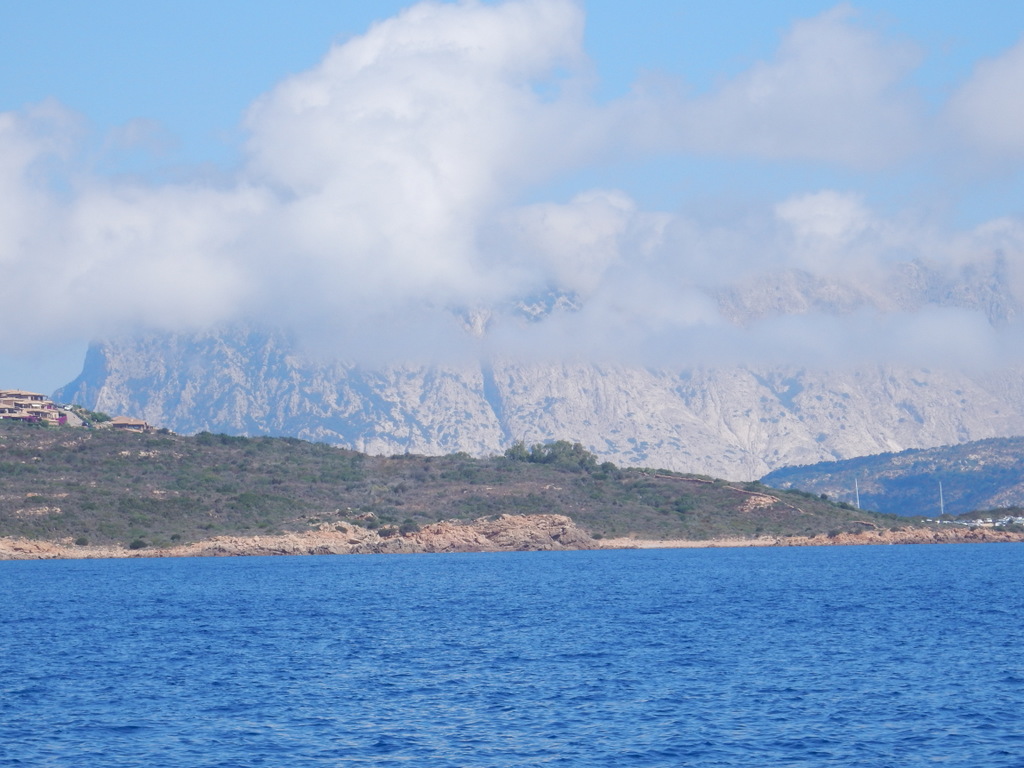
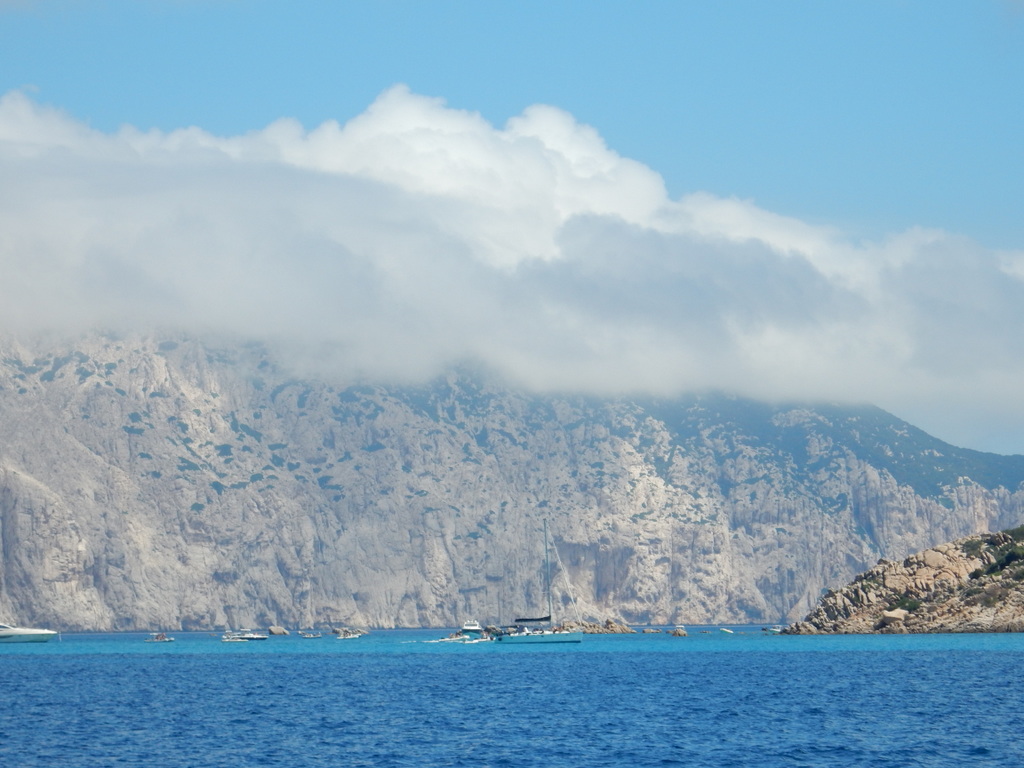
From Cala Luna, we did a full day sail north to Port Brandichi, a well protected bay 10 miles south of Olbia and two miles south of the beautiful island of Isola Tavolara, which rises 500 meters straight up from the sea with a top that is covered with clouds most of the day. The next day we sailed a few miles north to Porto Taverna and had an even better view of Isola Tavolara.
On July 12 we arrived at Porto Palma on the island of Caprera in the Maddalena Islands National Park. We arrived just the afternoon before a mistral was predicted. There were about 17 boats in the bay with us until evening and then they ALL left. Three small French cruisers (on what looked like instructional boats) came in and anchored for the night. Winds picked up and stayed at 25-34 knots for 2 full days from the west. There was very good protection in the bay, but it was still unnerving to have the wind howling for so long. We had bought a one-week park pass but no one ever came by to check. We stayed put and on the 2nd day Mark started feeling sick…. ear ache, sinus headache, then toothache, then fever. He decided to take antibiotics and spent 2 full days really feeling poorly. Once the worst of the winds passed (on Friday) a lot of boats came into the bay and all stayed overnight. The wind conditions for Friday were forecast to be very strong from the north, but they were not nearly as strong as predicted. On Saturday, July 16, Mark felt a lot better and we were very happy to pick up the anchor and leave. It was not a fun couple of days and we were running out of fresh food.
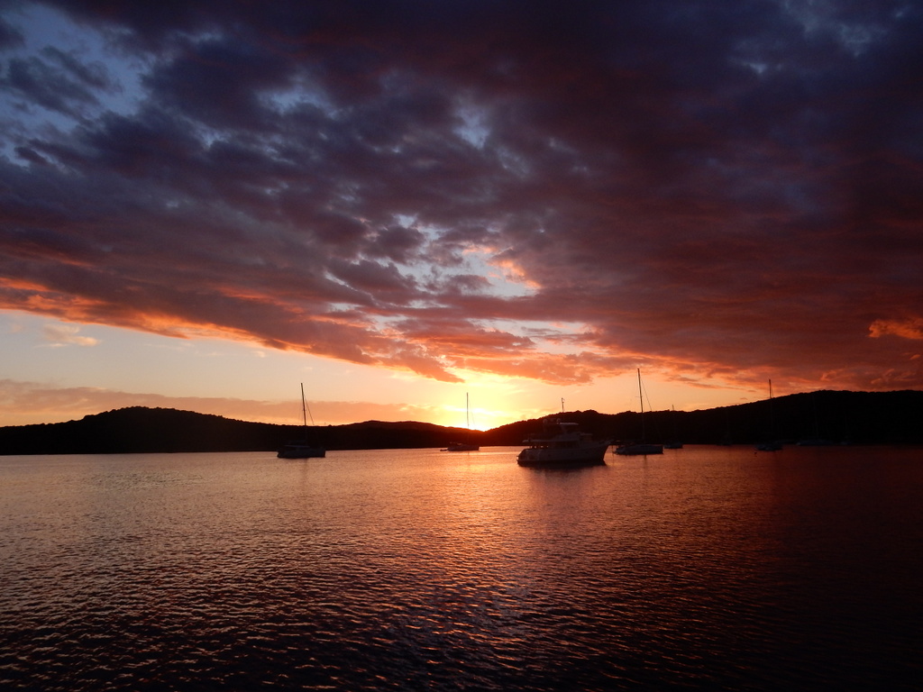
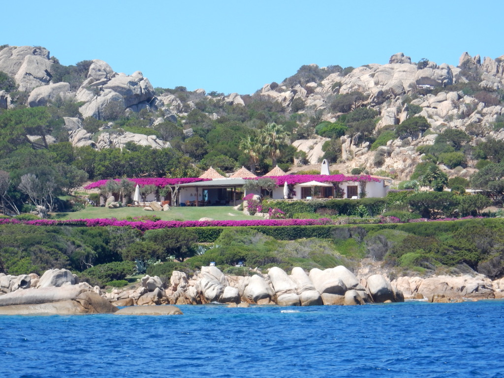
Isola TavolaraIsola TavolaraIsola Caprera sunsetIsola Caprera sunsetHouse with flowers in northern SardiniaBeach at Capo Testa
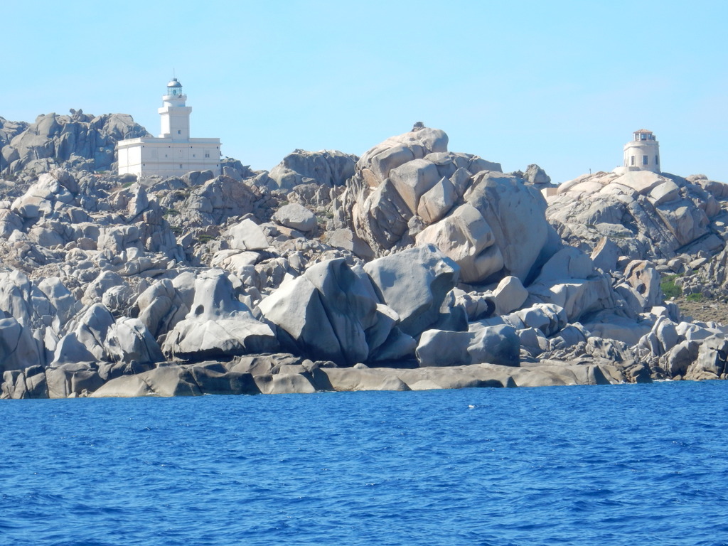
Capo Testa
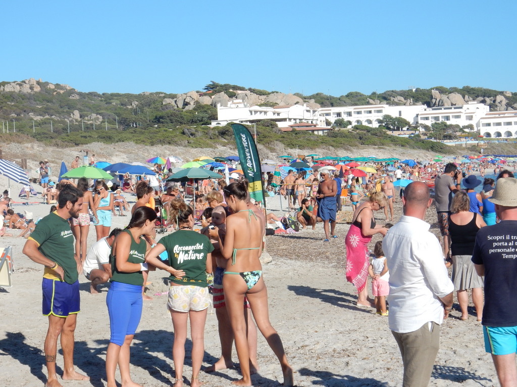
We sailed to Porto Puddu just a few miles away which had a busy but pretty beach and two outdoor music venues that competed for attention at night, making it on the noisy side. From Port Puddu we sailed to Baie di Reparata adjacent to Cape Testa, which is nearly the most northern point of Sardinia – as far north as Rhode Island. The bay is lined with beaches that were crowded with vacationers. We were short on food and there was nothing to buy in Capo Testa, so we took a bus to the cute town of Santa Teresa di Gallura to shop, explore, and eat at a restaurant.
On July 19 we sailed through the Bonifacio Strait that separates Sardinia and Corsica to La Pelosa, located in the smaller strait between Sardinia and Isola Piana at the far northwest of Sardinia. We found unexpectedly beautiful water there– very shallow with a white sand bottom. We so enjoyed sitting on deck and spending hours watching the full moon and twilight, we stayed for a second night. On July 21 we passed through the Fornelli Strait and started our sail south along the west coast of Sardinia. The prevailing winds on the west coast of Sardinia are from the northwest and west and the coast is wild with very few protected bays to anchor in or even towns with marinas. The population of the island is highly skewed to the east coast. The bay Cala del Bolla (part of Porte Conte) behind Capo Caccia seemed like a promising place to anchor. The hotel ashore was closed down but there was a beach nearby with a restaurant at which we had a very nice meal the first evening.
Every day we check more than one marine weather forecast for the coming days and one of these forecasts had an odd prediction for the next day at Calla del Bolla – 2 knots of wind with gusts to 30 knots. We had never seen that before. We presumed it to be a warning that thunderstorms would be moving through. We were well anchored and did not believe that the wind and seas associated with thunderstorms of short duration would be a problem. Lightning strikes are always our biggest concern but there is not much one can do to prevent the damage they might cause. There was no thunderstorm. Just as it got dark, the wind went from 2 knots to 30 knots in 30 minutes, switched to the southeast (rather than the predicted southwest), and stayed there. The southeast winds turned Sabbatical III so that it’s stern was just 30 meters from rocks on which a newly energized sea was crashing. Some boats nearby dragged anchor and left. One power boat tied up precariously to a navigation buoy in the dark. It blew hard at varying intensity all night so we stayed on anchor watch most of the night. On two occasions where it blew hardest, we turned the engine on so that if we dragged we could pop the engine into forward gear and get away before crashing into the rocks behind us. The anchor held for the night but the wind still blew in the morning and we needed to get away from this unsafe situation. We moved up very close to Capo Caccia just to get out of the waves so that we could lift our dinghy and outboard engine onto the deck. We called the marina at Alghero, about 7 miles away, and they had a place for us, so we sailed over in rough seas.
Both the marina and the town were much nicer than we expected. Alghero was founded by the Phoenicians in the 8th century BC and turned into a fortified port by the Genoese. In 1353 it was captured by the forces of the Crown of Aragon (Spain) and the local population was expelled, replaced by Catalan colonists. It is the only place in Italy where the Catalan language is an official language and is still spoken, particularly by older people. The Marina St. Elmo is located just below one of the walls of the fortified city. One steps off the dock and through St. Elmo’s Gate and you are inside. It is a very interesting place filled with tourists (mostly French) and many upscale shops and restaurants. It is a wonderful town for walking and exploring. As it was, we had to spend a second night in the marina as the weather forecast for the next day (Sunday, July 24) was abysmal. A succession of thunderstorms rolled through during the morning hours bringing many lightning strikes, torrential rain (a good thing for a salty boat), and winds to 44 knots. We were glad to be in the marina.
We left Alghero on July 25 and headed south. After a night behind Capo San Marco in the Golfo di Oristano, we finally reunited with “Vera†at the southeast corner of Isola Antioco, 15 miles past Carloforte. After a night there, we moved over to Porto Pino behind Cape Ta Menga. Porto Pino was one of our favorite anchorages of the trip. Beautiful water, a 2 miles long beach just made for walking, and an excellent restaurant. As for most Sardinia anchorages, it is not well protected so if the wind came out of the west or south one would need to leave. We had fine weather while we were there. On July 29th we separated from Vera again and motored north up the San Pietro Channel and finally re-entered Marine Sifredi, our home base in Carloforte after a trip of more than 40 days and 500 sailing miles. After seeing so much of Sardinia, Carloforte is our favorite place.
M. and L.
Britta at Porto PinoMark and Laura at Porto PinoBritta and Michael at Porto PinoBeach at Porto Pino with Sabbatical III visible in the background
We left Carloforte on June 16 in the company of “Vera.†The intent is to spend 4 to 6 weeks circumnavigating Sardinia while exploring its many bays. Our first stop was Malfatano on the southern coast (arriving Thursday, June 16). There is no town at Malfatano, only a small beach restaurant that also rents beach chairs, places for camper vans, and small boats. One has to travel down a dirt road to reach the beach and restaurant. Our first night at anchor was very rolly as the small bay is open to the south, but things were much more comfortable after that.
Marsh land at MalfatanoCape Malfatano
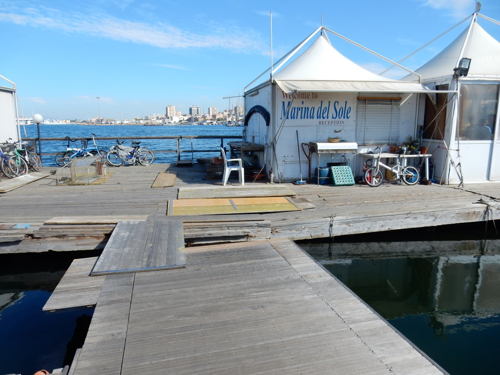
After three nights in Malfatano, we had to sail to the provincial capital of Cagliari for our appointment with the immigration police. We had a reservation at the Marina del Sole in Cagliari for two nights. Other marinas in Cagliari quoted me prices that were from two to three times as high as the Marina del Sole, which had a reputation of being somewhat rundown but friendly and well located. Sailing on a fixed schedule is always something we try to avoid, a view that was reinforced during our 50 mile sail from Malfatano to Cagliari on Sunday, June 19th. The weather forecast called for rain and possible squalls and strong wind, but we had to be in Cagliari Sunday evening to be in time for our Monday morning appointment with the immigration authorities. We had a great sail with some rain showers for the first two-third of the trip but as we approached the large Gulf of Cagliari we saw a huge bank of storm clouds coming towards us. We got heavy rain, poor visibility, lightening, and winds to 42 knots. We cautiously continued on our way to Cagliari with just a tiny amount of sail up but we did not dare enter into the breakwater in these conditions. I would not be able to back into a berth and Med moor in these winds. Suddenly, there was a break in the weather and we scooted in and berthed. Five minutes later, heavy squalls resumed for the rest of the afternoon.
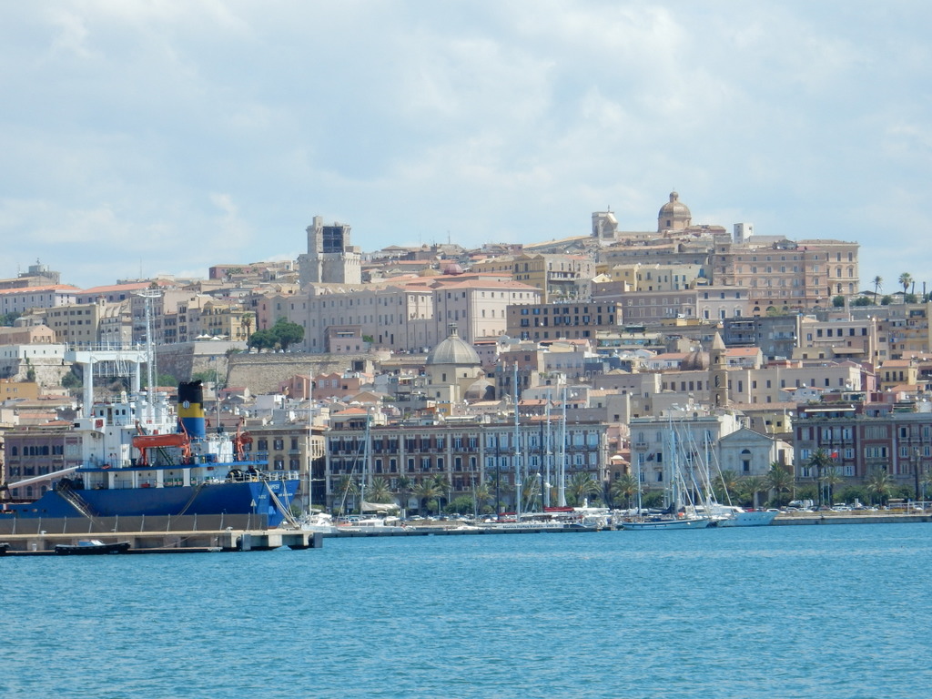
View of Cagliari from the harbor entrance.There is a reason that Marina del Sole is much less expensive than other marinas in Cagliari. There are holes in the docks, only one toilet for men and one for women, and it is in a general state of disrepair. However, the staff were very friendly and helpful.
In the evening, we headed out of the marina looking for a restaurant. To our surprise, at least half of the restaurants we passed were either all-you-can-eat sushi or “Asian†all-you-can-eat. It was certainly easier to find Asian restaurants than Italian. We walked until we found a cute hole-in-the-wall fresh seafood place (“Frito Maniaâ€) with only counter service and a couple of plastic tables and chairs on the sidewalk.
Flowers in the public garden, CagliariTree in the public garden, Cagliari
Monday morning we took a taxi from the marina to the office of the immigration police. We had an appointment for 9:50 am but we arrived at 9:00 am just in case. Outside the door of the immigration police there was a crowd of 60 or so people waiting. About half were African and most of the rest Middle Eastern or South Asian, all clutching forms filled out in Italian. The door opened and an Italian official called out names one at a time. You showed him some identify document, received a piece of paper with a number, and were allowed inside. Laura Pitt was about the tenth person called, followed by Mark Pitt and Brad Pitt. The immigration officer was making a joke although no one in this crowd laughed. Their business was certainly more urgent that ours and many probably arrived in a very different type of boat than we did.
The appointment time meant nothing. Everyone admitted inside pushed up against the counter trying to get the attention of an immigration agent…waving their forms and passports. More than once an agent came out from behind the thick glass security partition with small “talking holesâ€, like in a bank, to get the crowd to move back. The process was tediously slow. Small children ran around playing while their nervous parents talked with others or with the paid or volunteer agents who came to assist them, mothers nursed their babies, single men talked to countrymen in their local language or stared at their mobile phones. A fingerprint technician called out numbers in Italian which often led to no response from the crowd as they did not know Italian. Someone who did would try to find the missing person by checking the numbers in the hands of those waiting.
Just after noon, Laura was called. We expected an immigration interview, but there was none of that. The immigration policeman simply stapled together her photo to pages from Laura’s request for residency that we had sent to Rome two weeks earlier, while Laura watched. He entered things from the form on a computer screen. Then he took an index fingerprint from each hand using a 3M optical scanner, and told her to come back on June 30th for full hand fingerprints. They were doing full hand fingerprints of others right then but he said that there was a separate queue for the fingerprints and the first opening was June 30th. And even then, we would not have our residency permit. Then it was my turn. For some reason, the computer in Rome would not accept the data that the immigration agent had entered. He swore at the computer (all in Italian, of course) and pounded on the keyboard to no avail. He told me to wait until the computer in Rome accepted my form, and he started to process the next applicant.
I waited and waited but the computer glitch persisted. Laura needed to use the women’s bathroom but it was not in working order. Finally, the agent said he would call Rome. He went into the back and emerged some minutes later and was able to get me processed. By then it was close to 1 pm and the waiting room was almost empty and their operation would cease for the day.
We walked to the nearest main street and hopped the first bus heading in the direction of the waterfront. We got off right in front of an all you can eat sushi restaurant. We ran in to use the bathroom and then remained for a very good lunch at a very good price. Walking around town and riding in the public bus we noticed that there was a considerable number of people of Asian descent who were obviously not tourists, which helps explain the number of Asian restaurants. We had seen none in Sicily.
We sailed back to Malfatano in benign conditions the next day (Tuesday, July 21) and finally crossed paths with our friends Dick and Lynn Bisanz from St. Paul, Minnesota on their catamaran “Wind Pony.†We missed seeing then in Sicily but we kept exchanging emails as to our respective whereabouts. We had three nice days with them and their sailing mates from New Zealand on “Dol’Seleneâ€. They are now in Minorca on their way to Gibraltar, the Canaries, and across the Atlantic. Then our Aussie friends Melinda and Dave from “Sassoon†arrived by design as well. We met them first in Malaysia and then spent two years with them at the Kas Marina in Turkey. They are also on their way to cross the Atlantic.
Melinda and Dave of “Sassoon†pose with Laura at MalfatanoSabbatical III, Vera, and Sassoon anchored together at MalfatanoChildren play in a fishing boat (Malfatano)
From Malfatano, we sailed with “Vera†to Pula on the southeast coast of Sardinia. The Vera’s left after one day but we remained in Pula for two more nights as it was close to Cagliari where we needed to get our full hand fingerprints done. We hoped to leave the boat at anchor in Pula and take a bus to Cagliari but the weather forecast suggested that would be risky for the boat. So on June 29th we sailed back to the Marina del Sole in Cagliari and the next morning waited in the same room at the immigration police office until we were called for fingerprinting. We recognized and greeted some of the people waiting. We waited for two hours until our number was finally called.
After another sushi lunch, we provisioned the boat at the very nice “Nonna Isa†supermarket, which delivers to yachts, and gave her a good wash. We left for Villasimius in the Gulf of Carbonara yesterday (Friday, July 1) to rejoin “Vera†who had been anchored there since they left us in Pula. We expected 7 knots from the southeast but 5 miles out we here hit with easterlies of up to 25 knots. That made for a long slog tacking upwind which was actually a nice, exciting sail as we were in no rush. Now we are just anchored out on the west side of Cape Carbonara but will switch to the east side later today when the wind shifts west. The boat is full of fruit, veggies, cheese, drinks, and chicken, plus a varieties of treats, plus we got rid of all the garbage we were accumulating. Stopping in a big town like Cagliari has its advantages as long as you do not fall through a hole in the dock.
M.
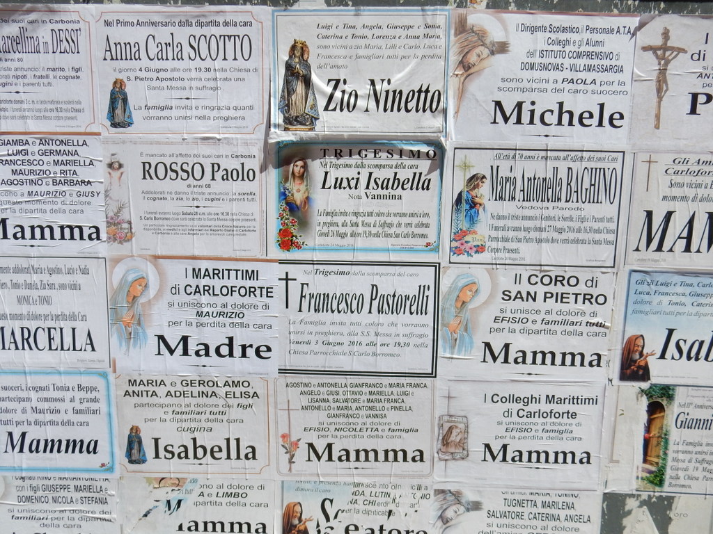
A short satyr appears at the ridge line after sunset in MalfatanoThe Italian Financial Police pose after checking us out in Malfatano to be certain that we are not rich Italians on an untaxed sail boat. They were very friendly and professional.Britta and Michael enjoy the sunset hour on the foredeck of “Vera†while berthed in Carloforte.Britta sits on the foredeck of “Veraâ€Death remembrances are posted on boards in Carloforte.
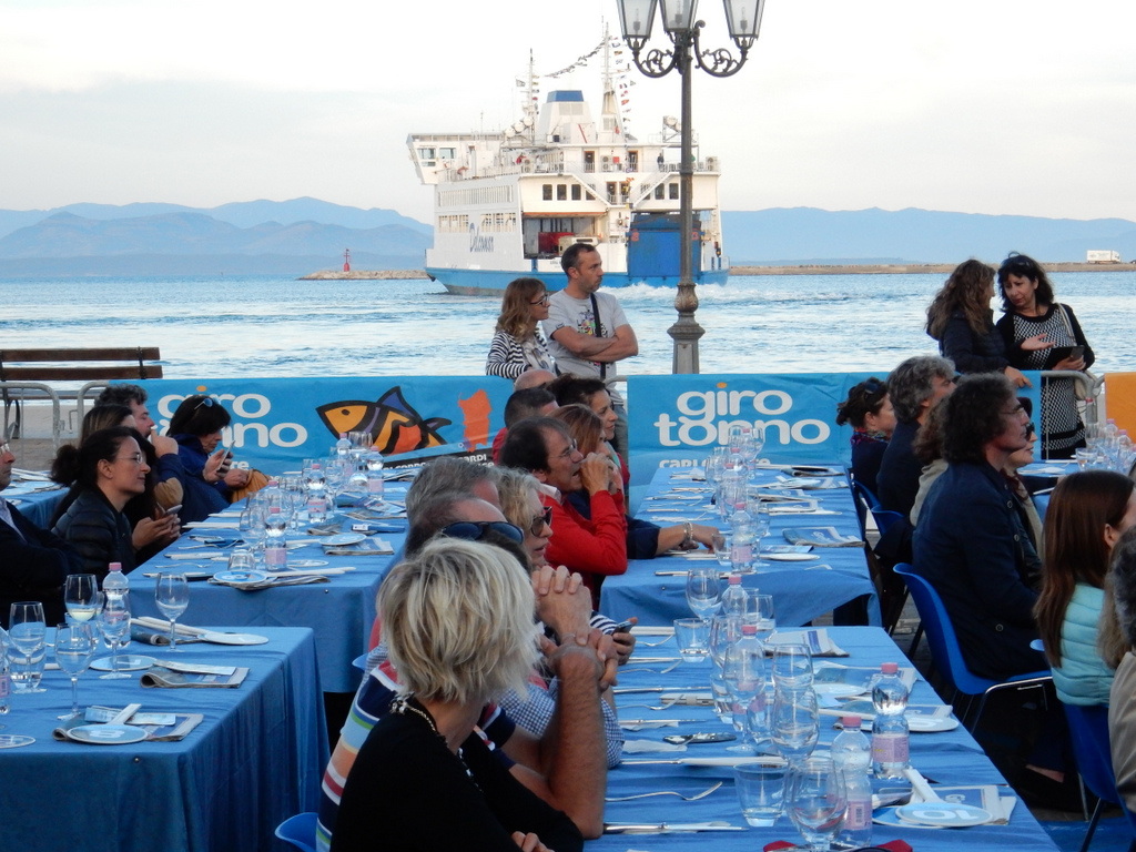
Street in Carloforte decorated for Giro Tonno (Tuna Festival)
(Note: Posting of this entry was delayed for almost two weeks by issues with our our web site host, Aabaco, which is part of Luminate, which was recently spun-off by Yahoo, which by itself pretty much explains why we had a problem. Our website was also unavailable for most of that time. Hopefully, this will not be repeated).
We left Sciacca, Sicily at 6 pm on Wednesday, May 25 and crossed the Tyrrhenian Sea to Carloforte on Isola San Pietro just off the southwest coast of Sardinia. We motored for 12 hours before the southeasterly wind came up enough to sail. The wind forecast was spot on as the wind increased through the day on Thursday becoming 20 knots from the east and then 25 knots from the northeast as we rounded the southern tip of Sardinia. We had a poled out genoa and a mizzen set on a preventer almost the whole time that we sailed and arrived in Carloforte early on Friday morning (May 27). Our friends Michael and Britta of “Vera†tracked our progress for the last few hours from our AIS signal and were at the dock to greet us and help with lines as we backed in.
We have been in Carloforte for two weeks and this place has exceeded our expectations. We are in a small, secure marina run by the Sifredi family. It is quiet at night, the bathrooms and shower are clean and close enough to the boat, and there is almost always a good breeze. Just across from us is the town with cafes, restaurants, a Conad supermarket, gelaterias, fish stores, bakeries…pretty much all we need. I ordered some things from Amazon Italy that I could not get in town, plus some boat parts from Sweden and the UK, which is easy to do within the EU.
Flamingos wade in the salt pan next to townCoast of Isola San Pietro
The island of San Pietro is only 19 square miles and has a population of less than 6500 inhabitants. It has an interesting history. It original inhabitants are from Liguria, the coastal area of Italy bordering France, by way of Tunisia. The Tunisian coastal island of Tabarka was given as a concession by the Bey of Tunis to the Genoese family of Lomelli in 1540, in return for the release of the captured pirate Dragut. The Lomelli family recruited Ligurians to colonize the island and undertake coral fishing. These Ligurian colonists spent two hundred years in Tabarka, Tunisia in relative isolation until relations with their Arab neighbors deteriorated, and the coral reefs were exhausted. Thanks to the King of Sardinia, Carlo Emmanuel III of Savoy, the Tabarkan community was relocated to the uninhabited island of San Pietro in 1741 where they founded the new town of Carloforte, named in honor of King Carlos. The Genoese fortress at Tarbarka was surrendered to the Bey of Tunis, but still stands.
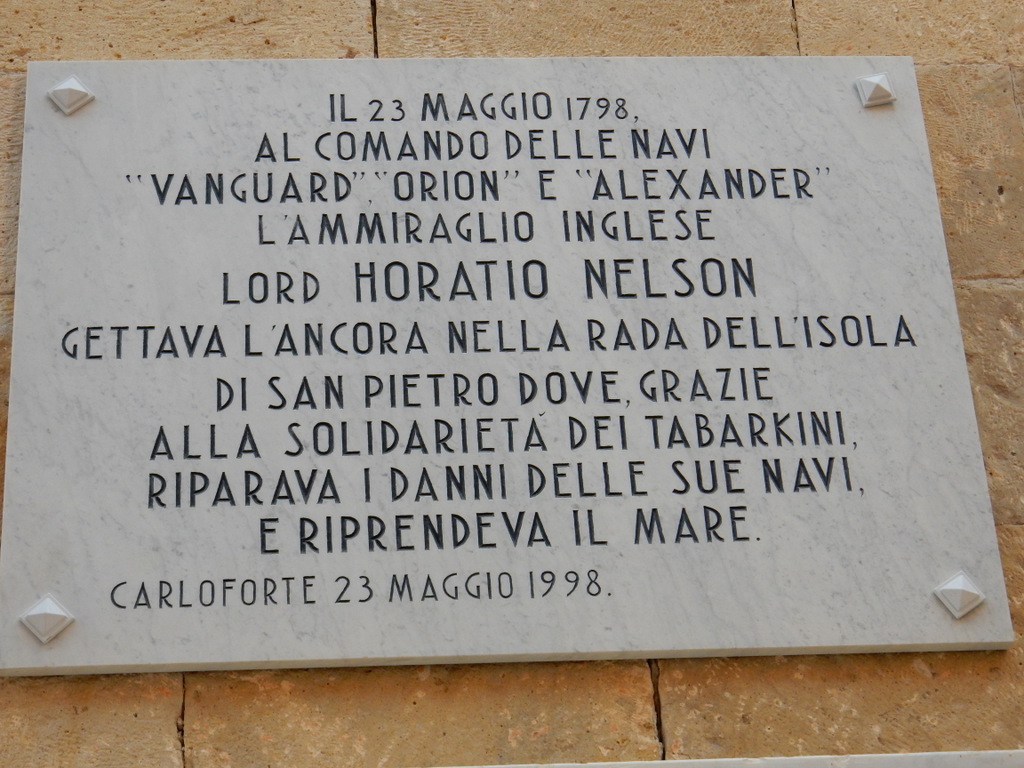
Piracy was a huge problem for the southern coast of Italy, Spain, and Greece for hundreds of years, with the pirates predominately Arabs from the North African “Barbary” coast. Long stretches of the coasts of Spain and Italy were abandoned. The island of San Pietro, where Carloforte is located, was no doubt uninhabited in 1741 for that reason. A fort was built to protect the newly transplanted population (the “forte” in the name Carloforte). It was not enough. In September 1798, pirates based in Tunisia raided Carloforte killing many and abducting 800 persons to sell as slaves. The captives were held for more than five years until Napoleon intervened militarily to free most of them. He is honored with a statue, plaques and names in town. Our favorite cafe on the waterfront is the Cafe Napoleon. Lord Horatio Nelson, the English admiral, is also honored with a plaque outside the church for his help in fending off pirates.
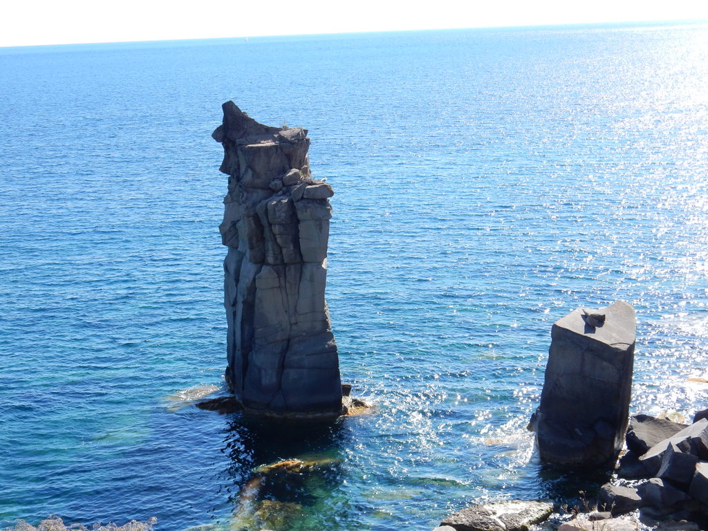
“Columns of Carloforte”Coast of Isola San Pietro looking towards Sardinia
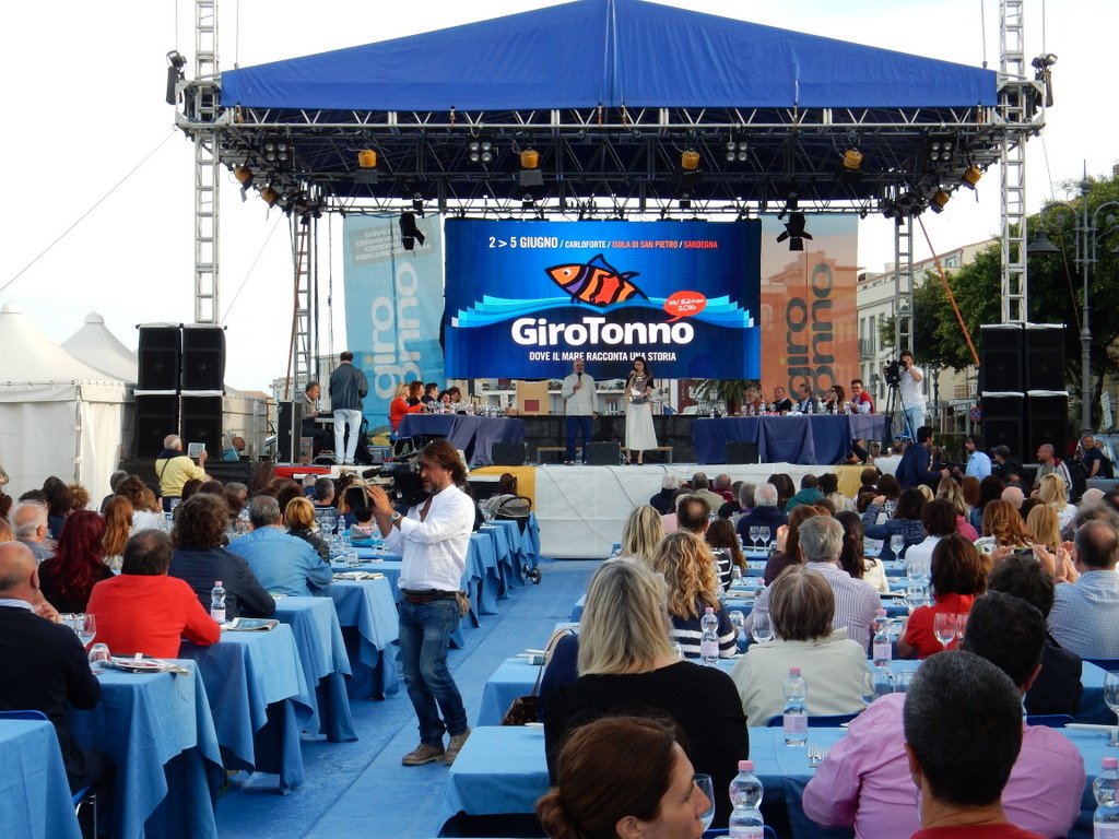
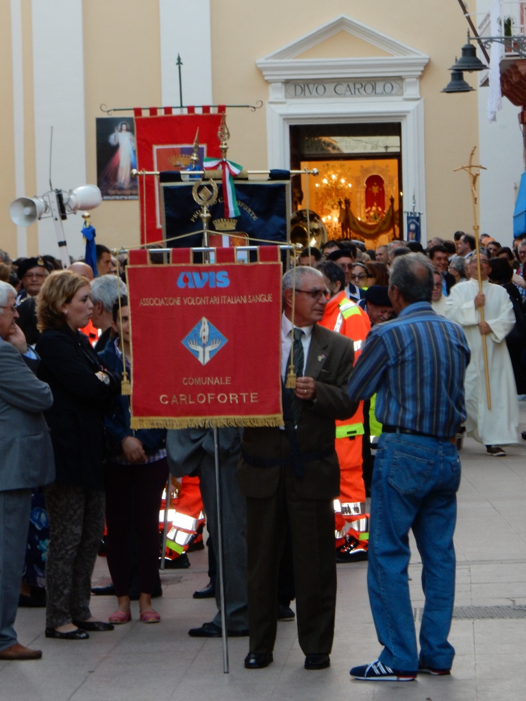
The Tarbakini speak Tabarkan, a dialect of Ligurian that evolved during their isolation in Tunisia. It does not sound like Italian. They also have their own customs and cuisine that can be sampled in many restaurants. Tuna fishing and canning was a major occupation since the Tabarkini were re-located to Carloforte and is still carried on today at a much reduced scale, although all of the tuna canning factories have closed. At the annual Giro Tonno (Tuna Festival) which we attended last week, they still show off their traditional method of catching tuna. At this time of the year, bluefin tuna migrate in schools in the San Pietro Channel, the body of water between Carloforte and Sardinia. Fisherman direct the tuna through a complex set of net barriers until they reach the “death chamber” where they are pulled out of the water and impaled on spikes in an act known as “matanza” or “the killing”. Old photos show massive bluefin tuna being caught and even now they are typically 30 kilograms in size.
Judging tuna dishes prepared by a group of international chefs at the Giro Tonno, CarloforteFerry departs while tuna dishes are judged, Giro Tonno, Carloforte
Plaque in honor of Lord Nelson
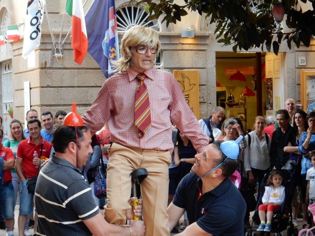
Clown on unicyce entertains in the town square during Giro Tonna
Tomorrow, we leave Carloforte to visit the bays and anchorages of the east coast of Sardinia, and to visit the police in the Sardinian capital of Cagliari to finish the formalities required to get our Italian Residency Cards.
M.
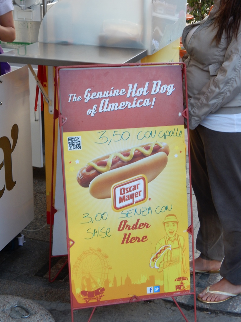
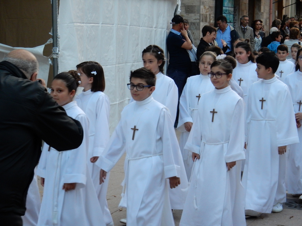
If you do not like Tabarkan or Italian food in Carloforte, you can always get on Oscar Mayer weinerFirst Communion procession, CarloforteFirst Communion procession, Carloforte
We left Siracusa on May 18 intending to head west along the southern coast of Sicily stopping overnight in various places in order to shorten the final leg of our trip to our new home in Sardinia. Our first stop was the large Marina di Ragusa near the city of Ragusa. We spent only 12 hours there before heading for Licata where we spent three days at the Marina di Cala del Sole. It is a new and not yet complete marina set in a planned tourist development that came to a halt in the Great Recession. Unfinished construction and idle cranes attest to the speed at which this project came to an abrupt end. The marina had lots of space and is very well protected by extensive breakwaters. The only problem for us is that wild dogs took up residence in the vacant land around the marina and they bark periodically throughout the night. Not a good situation for sensitive sleepers like us. Licata is an interesting town and we enjoyed walking around and sampling its ristorantes and trattoria. There is a Conad supermarket next door to the marina which proved very convenient for us.
Local people strolled along the quay of the marina in Licata every evening and all day on Sunday
On May 24th, we sailed 50 nautical miles west to the town of Sciacca, where a large fishing fleet is based. We were able to med moor at the pontoon of the local chapter of “Lega Navale Italiana”, a national association of Italian boaters. This is a charming town that dates back to the Greeks who enjoyed soaking in the thermal springs, as did the Romans who followed. It architecture reflects its occupation by, successively, Vandals, Ostrogoths, Byzantium, Arab North Africa, Normandy, and Aragon Spain. It was once a great port for the grain trade.
View of Sciacca at sunsetThe city is full of painted ceramic tiles. There are at least a dozen large displays at the Lega Navale dock. These are on the stairs from the harbor to the town up on the hill.We found our way into the old Jewish district and found the location of one of the 14th century synagogues. Jews were forced to convert or be expelled from Spanish-ruled Sicily in 1492, as in all Spanish lands. Siracusa, Licata and Ragusa also had Jewish communities before the Inquisition.The Lega Navale dock in Sciacca. Sabbatical III is the closest boat.The Lega Navale dock as pictured in painted ceramic tiles. The buildings pictured behind the boats are actually in the town center located up a steep hill from the marina.Sabbatical III at Lega Navale, Sciacca.
Tomorrow evening, Wednesday, May 25, we leave Sciacca for the 260 nautical mile passage to Carloforte, southwest of Sardinia. We will be taking advantage of two days of (forecast) easterly winds to get to Sabbatical III’s new home marina without having to head directly into the prevailing westerlies. We should arrive sometime during the day on Friday.
We are now in Sicily, berthed comfortably in the little marina “Marina Yachting†in the adorable, historic little town of Siracusa. We took two weeks to get here from Turkey, covering a little over 800 nautical miles, with several all day sailing days, a total of 3 nights at sea, and a number of beautiful stops on the way (including several days at our favorite Greek island of Antiparos). The only really tiring part was the last two and a half days when we crossed the Ionian Sea between the southern Peloponnese and Sicily. We had a good sail, with wind much of the way. It seems that we are pretty much the only cruisers out yet as we did not see a single sail boat across the whole Ionian. There were hundreds of cargo ships, but fortunately all seemed to be just enough north or south of us that we could relax for the most part. Our AIS system identifies every boat of size that is out there so we always know what is coming up within about 35 miles, and sometimes much more.
We left Kas on the 24th of April and headed up the Turkish coast to the area around Bodrum. It was a detour from our route to Italy, but it was necessary, as we had to test out our new sails and rigging before leaving Turkey. We did an overnight sail (162 nm) from Kas to a very pleasant little marina at Port Iassos in Mandalya Bay (Güllük Bay) in the “Turkish Riviera.†Everything worked beautifully on the boat. This was a big relief as it is a bit scary heading out with brand new rigging and new sails. You never know if something is going to break.
Saying farewell to the staff of the KaÅŸ Marina.
We are friends with a warm and friendly Turkish couple (Mehmet and Begum on Kabuk) who were in Bodrum working on their boat. Bodrum is very close to Port Iassos so we took a bus there and spent a wonderful day with them before we continued our trip north. Our next stop was the town of Didim where we had arranged for our riggers/sail-makers (from Q Sails) to come and do adjustments to the rig. It was only a short sail between Port Iassos and Didim, but the winds were strong and right on the nose so we had a great opportunity to really test out the rigging and sails one more time by tacking to Didim. The marina at Didim was very nice and we enjoyed a couple of days there, meeting a wonderful American couple from LA (Mohammed and Ety on an Amel 54) as well as a very friendly Swedish couple on the Amel Super Maramu Kerpa. We hope we will run into these people again.
Güllük harborMehmet and Begum in BodrumLettuce from the market in Güllük
The riggers spent a few hours making adjustments to the rigging and delivered our spinnaker newly modified to be part of a Selden anti-torsion rope furler. Unfortunately, we did not have time to test it out, so if it needs adjustments we will have to have it done here in Italy.
Antiparos, GreeceAntiparosOur favorite restaurant in Greece — Captain Pipinos in AntiparosGeorgio, our friendly waiter at Captain PepinosSunset in Antiparos
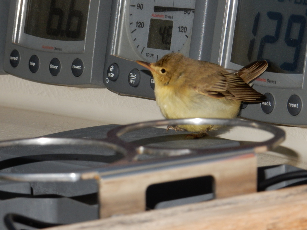
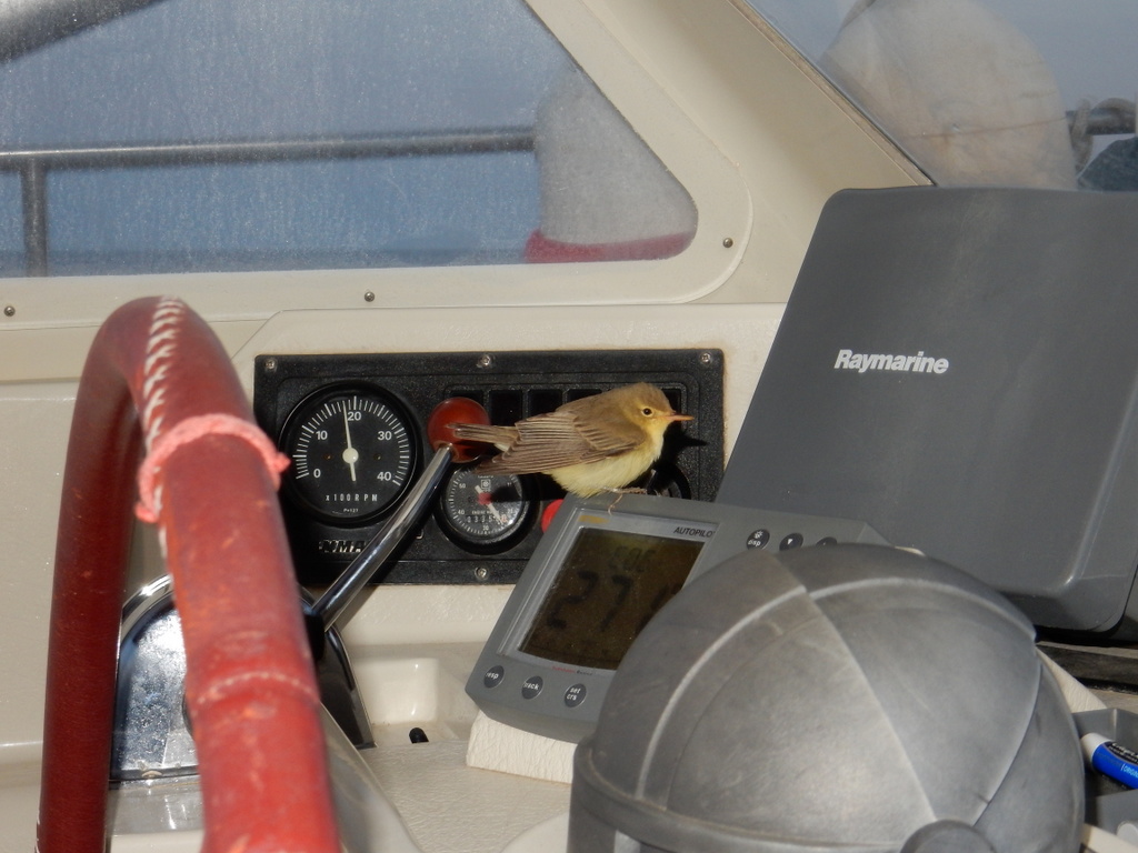
We had a whole little drama on the boat during our passage that involved three small, land-based birds that must have been blown out to sea by the sudden change to strong southeast winds that we rode to Italy. There were two very pretty green-breasted birds, and one aggressive black and red bird. We don’t usually have birds with us while we are at sea, but three of them were on board as we crossed the Ionian and kept making random appearances during the trip….. at various times we found them inside the boat (near the bed and then on the navigation station), and other times we saw them in the cockpit and on the deck…. always looking as if they needed shelter from the cold wind. We tried to feed them, but they did not take the food. It also became apparent that the black bird was attacking the green-breasted birds, killing one of them. On the last night, the other one fled into the cockpit and hid behind the radar screen as the black bird sought her out. By the end of the trip all three birds had died.
One of our bird passengers checks out the instrument displaysOne of our bird passengers checks out the instrument displays
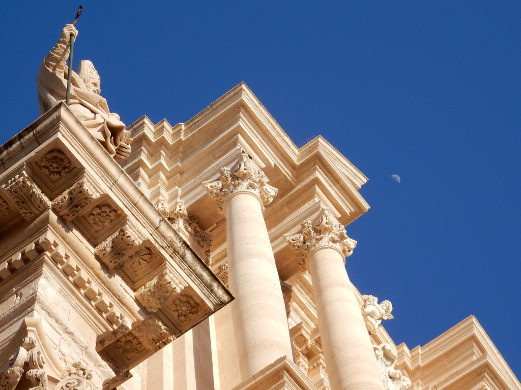
We have been in Sircusa for four days and we find it a delightful town. The city was founded by the ancient Greeks 2700 years ago and was a powerful city-state that once equaled Athens in size. The city is listed by UNESCO as a World Heritage Site. It is a wonderful place to explore on foot and the food is great.
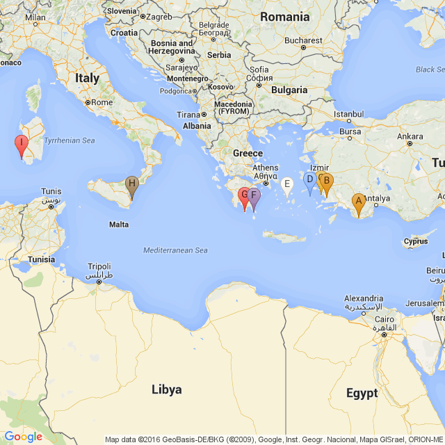
The map at the bottom shows where we have been and the location of our new home base at Carloforte on the island of San Pietro just to the southwest of Sardinia.
L.
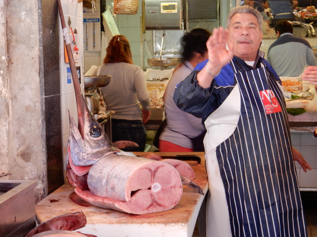
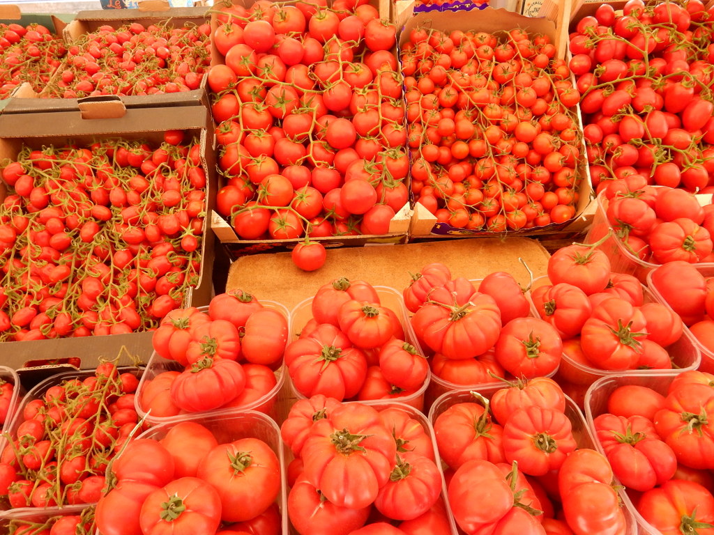
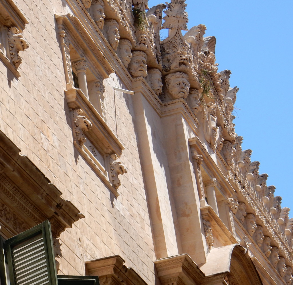
Siracusa (Syracuse), Sicily, ItalySiracusa (Syracuse), Sicily, ItalySwordfish is common in SiracusaAs are tomatoesCathedral, SiracusaSiracusaPiazza, SiracusaSiracusaSiracusa
Map of our recent travels
A. Kas, Turkey
B.Gulluk, Turkey
C. Didim, Turkey
D. Patmos, Greece
E. Antiparos,Greece
F. Elafonisos,Greece
G. Mezapos, Greece
H. Siracusa, Italy
I. Carloforte, Italy