Return from Corsica: Alghero and Bosa, Sardinia

View of the river city of Bosa (Sardinia) as we come up the River Temo in our dinghy. The Malaspina Castle overlooks the city.

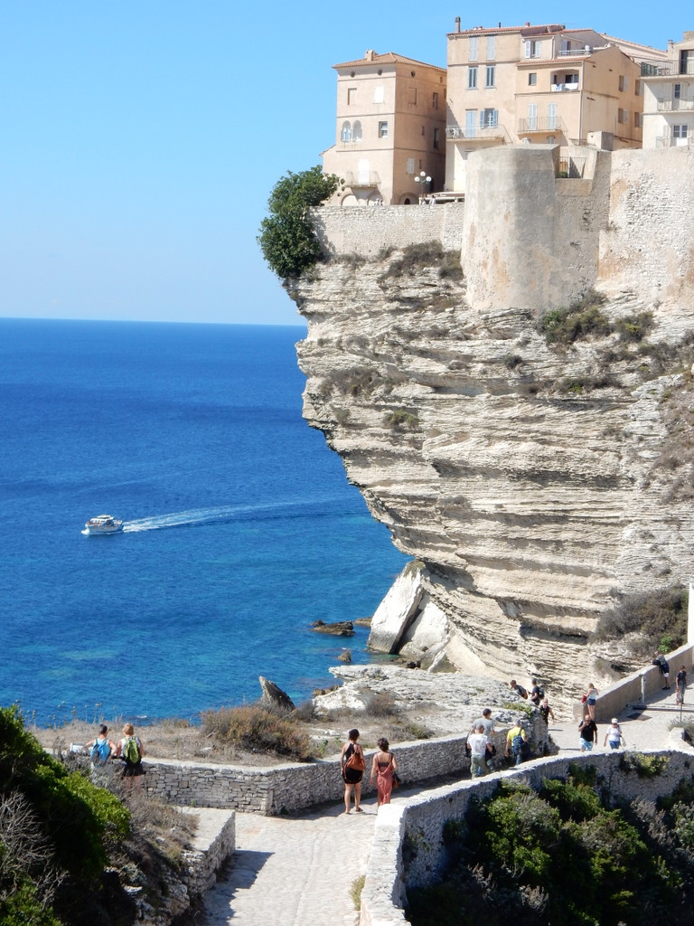
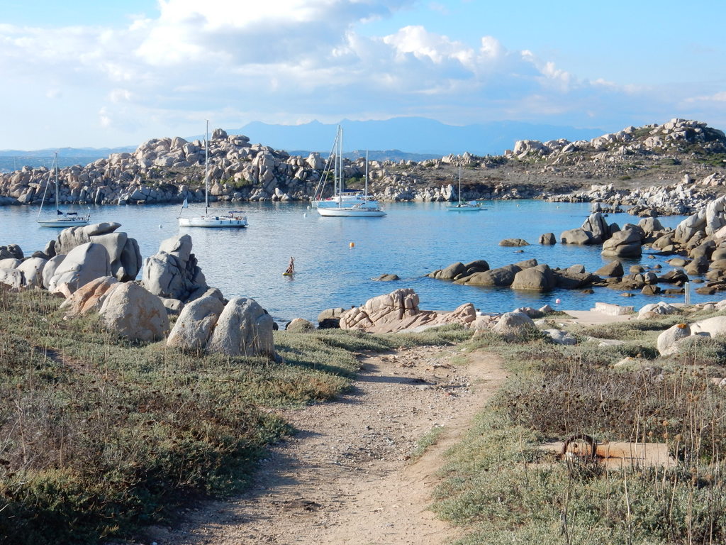
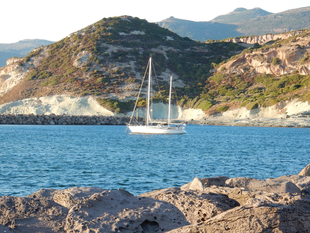
After a night at Lavezzi Island on the French side of Bonifacio Strait,  we crossed the Strait to the “La Colba” anchorage on the south side of Capo Testa, Sardinia on September 27th.  Overnight the winds shifted to easterlies and built during the next day to 25 + knots.  We did not leave La Colba especially early since we knew that with this wind we would have little trouble arriving at our anchorage on the northeast side of the Fornelli passage, at the far northwest tip of Sardinia, before sunset.   As we neared the Fornelli Passage we were concerned by how the seas had built up and were funneling into the Passage.  As we approached our primary and secondary anchorage locations, we could see that they were untenable in these seas but that there was still plenty of light to navigate the Fornelli Passage itself and look for a place to anchor behind Isola Piana on its more protected western side.  Unfortunately, there was nothing but rocks on the western side of Isola Piano and there were breaking waves to its south.  There was still plenty of daylight left so we turned the corner and headed south along the wild west coast of Sardinia to look for a place to anchor for the night.  Our pilot book did not list an anchorage closer than Porto Conte which, at 30 miles away, was and too far to sail to before dark even in the great winds we were experiencing.

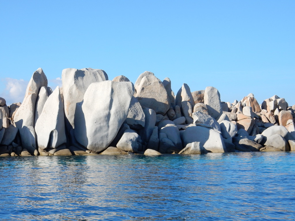
A quick study of the charts and a Google search suggested that Cala Santa Nicola, about 15 miles away, would likely provide protection from the strong north-easterlies, although there was some doubt about the suitability of the sea bottom to hold an anchor.  The small bay was almost uncharted and supposedly had a dangerous rock in the middle, so we inched our way along the northern shore.  We had to come in fairly close to get protection from the swell but Laura could only see a solid rock bottom from her perch at the bow.  We dropped anchor anyway and sure enough, it was a solid rock bottom.  The anchor just skittered along the bottom, having nothing to grab onto.  We tried again even closer to the sandy beach and had the same result.  There was nothing to do but head to Porto Conte.  We had lost 45 minutes with our deviation to Cala Santa Nicola and even though we could sail 7.5 – 8.5 knots in the strong north-easterlies, it would be dark by the time we arrived at Porto Conte.

We almost never arrive at an anchorage in the dark.  In this part of the world, one really needs to see the bottom.  If you drop in sea grass, you may think your anchor is holding but it probably won’t, especially in strong and shifting wind.  We had been to Porto Conte in July and had to spend some time looking around for a patch of sand in Calla del Bollo at the southern end of the bay.  Based upon that experience, we definitely did not want to anchor in the same place in the dark.   Some months before, Michael and Britta of “Vera” had supplied us with a waypoint for a place to anchor in Cala Torre del Conte, in the northwest corner of this large bay.  We decided to head for that waypoint.  We arrived in total darkness and blindly dropped anchor.  The anchor seemed to hold and we settled in for a late supper and sleep.  It had been a long day and our passage was twice as long as what he had planned. The next morning Laura went for a swim with snorkel and goggles and found that our anchor was in the only patch of sand in a bottom of sea grass.

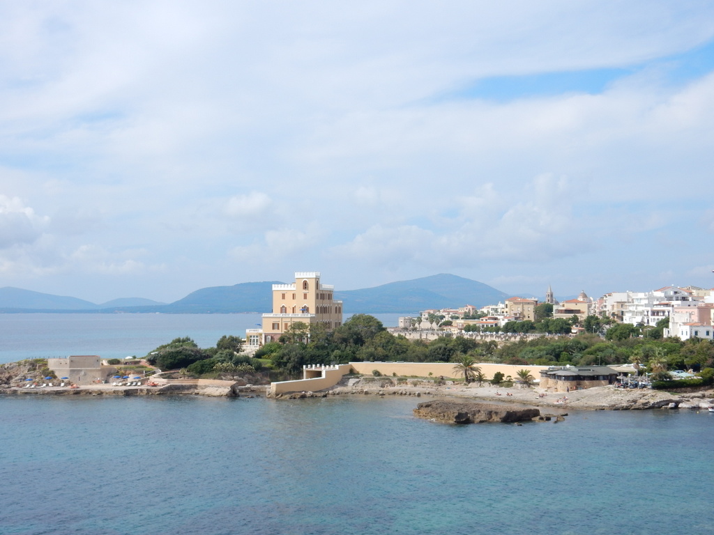
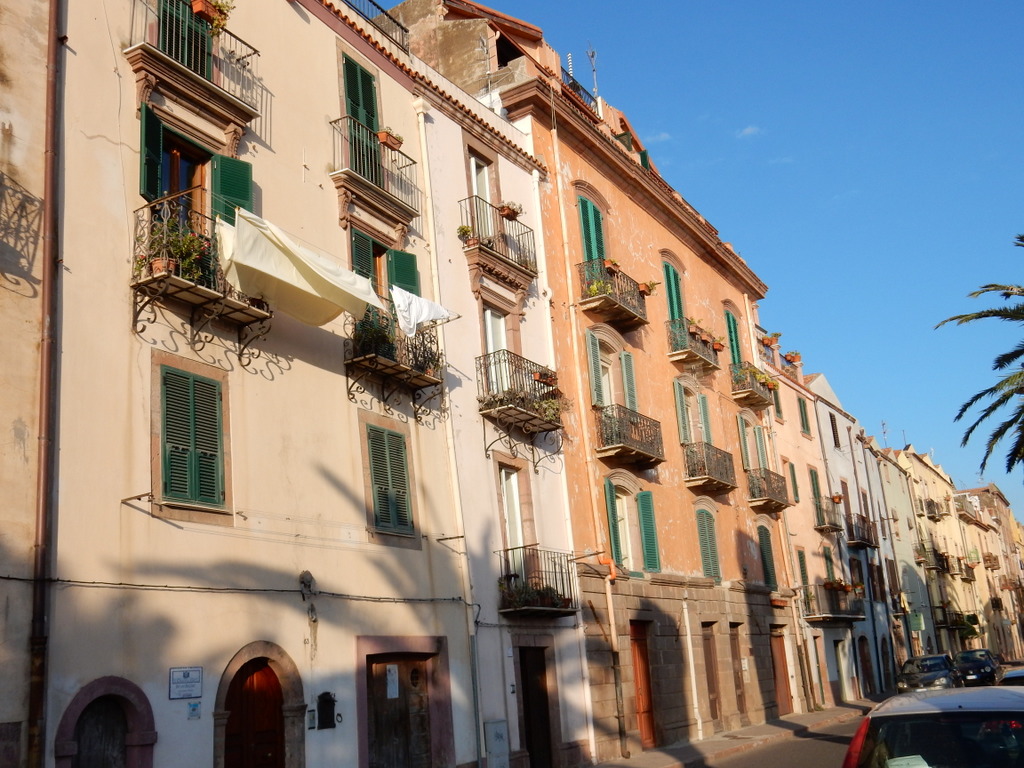
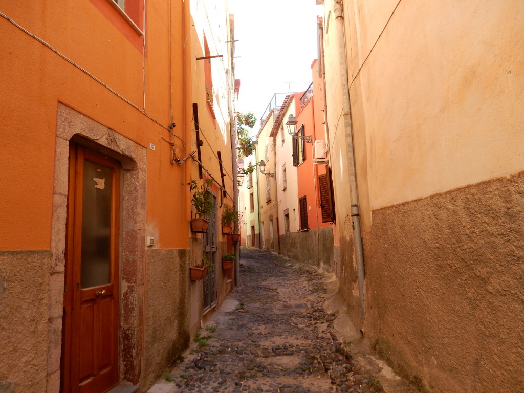
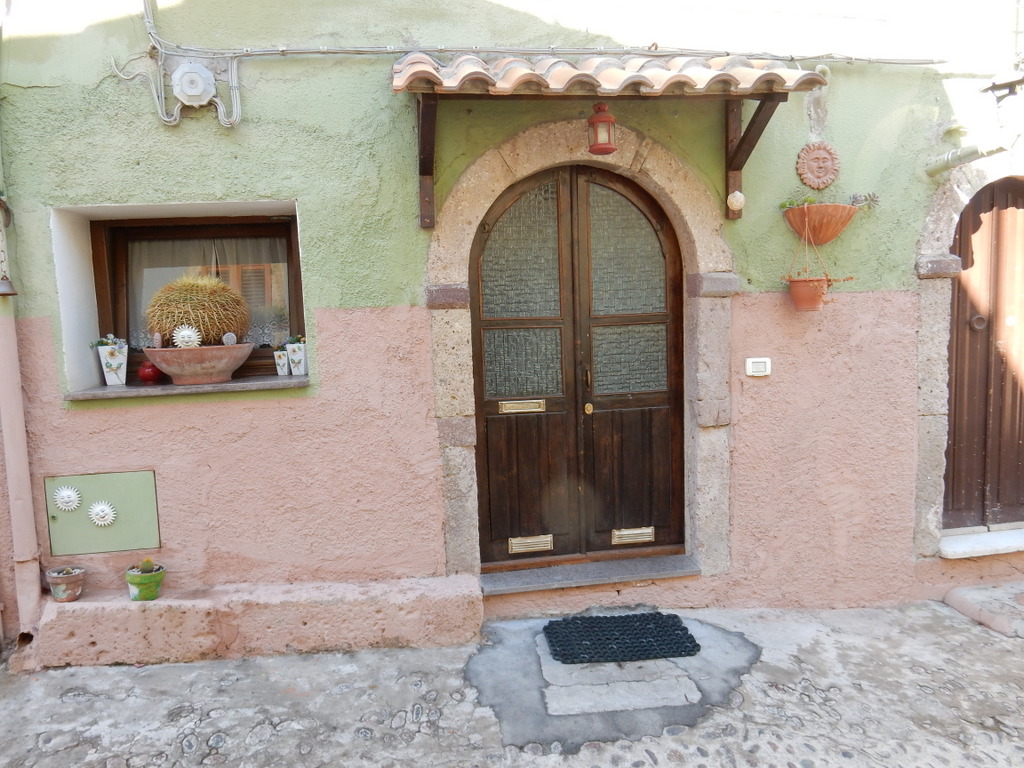
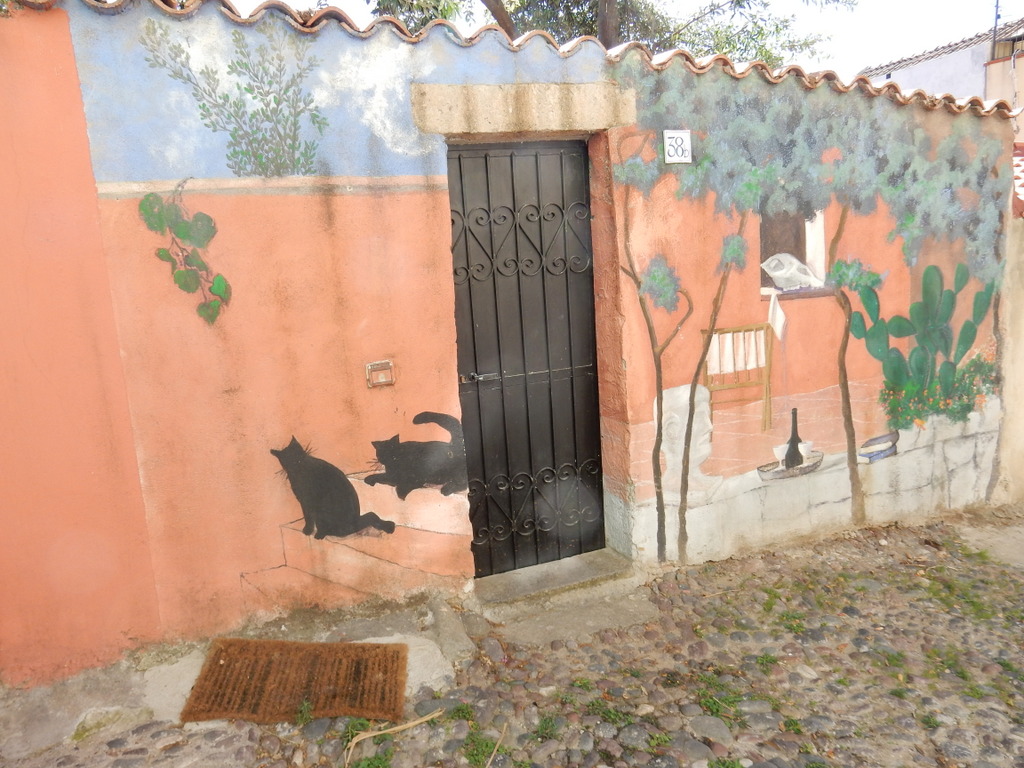
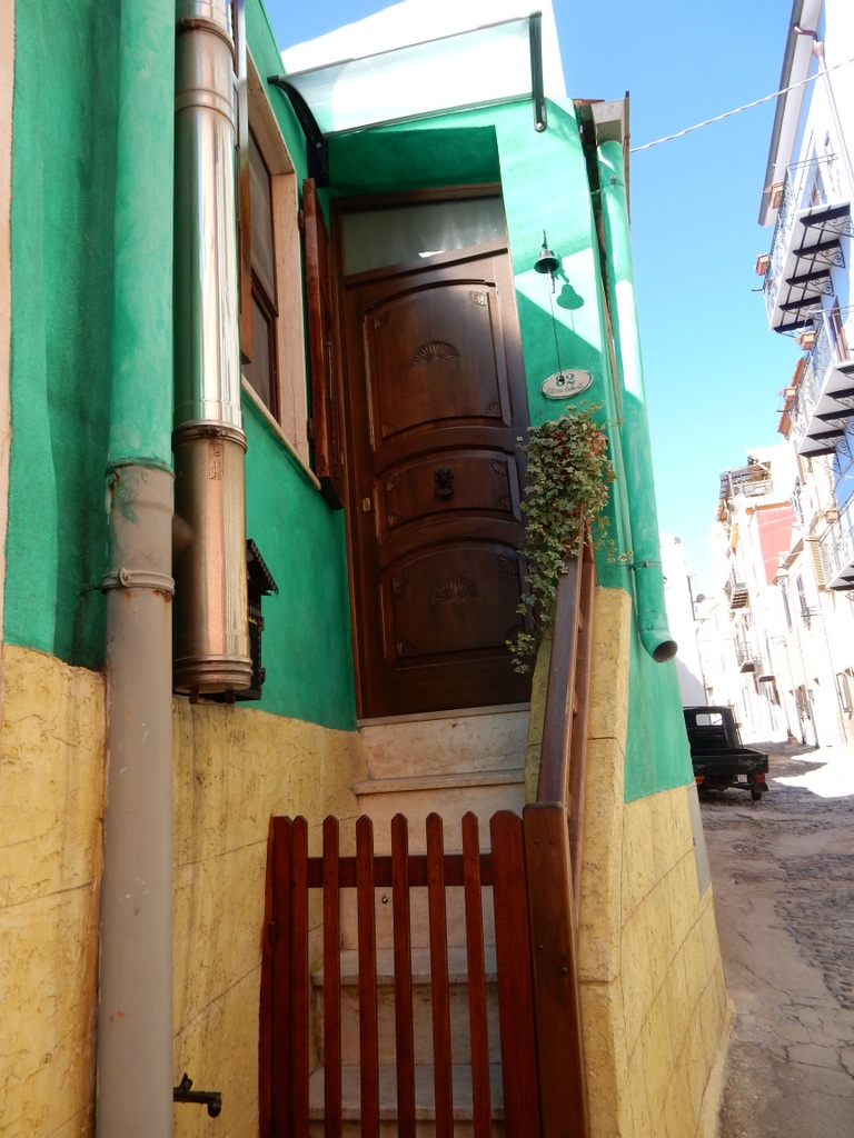
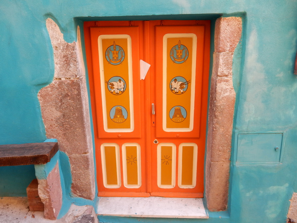
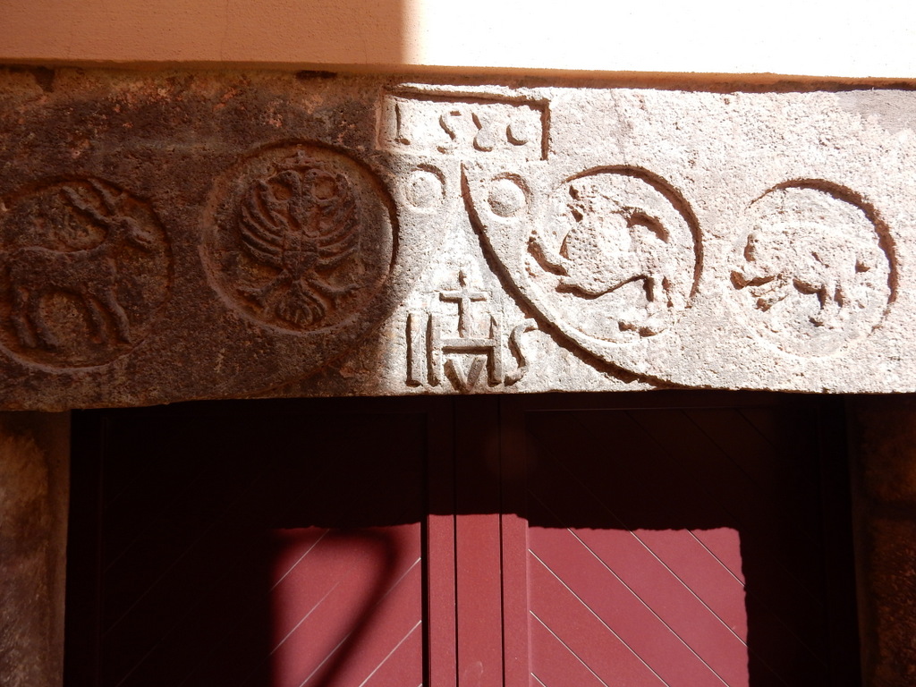
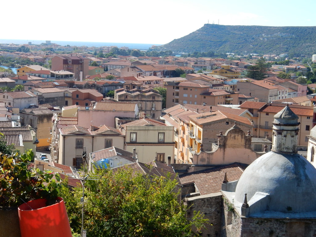
Later that morning (September 29), we sailed over to Marina di Sant Elmo in the city of Alghero.  We had stayed in this marina for two nights in July and found it comfortable and had really enjoyed walking around Alghero.  This time we spent five days in Alghero and enjoyed this old Spanish walled city as much as we had in July.  The weather was fine as we walked in the narrow streets and along the city walls and found some great restaurants.  The tourist crowd was gone and we did not need reservations to eat anywhere we wished.  We also found a marine canvas guy who fixed our damaged bimini.

The walled city of Alghero (Sardinia) as seen from the sea
View of Villa Las Tronas and Alghero

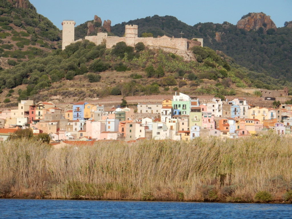
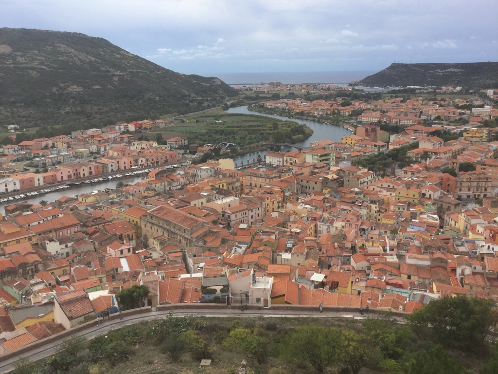
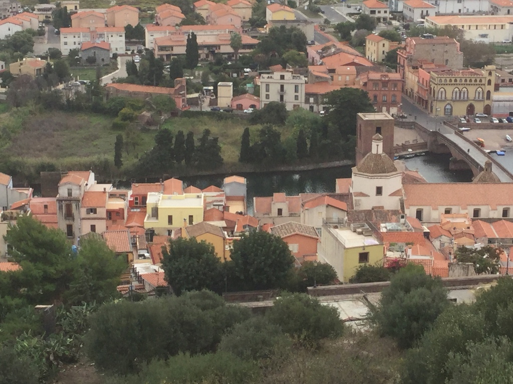
We left Alghero on October 4 and sailed south to the mouth of the River Temo and anchored behind a new breakwater built to make the entrance to the only navigatable river in Sardinia safe from breaking seas.  A bit more than 2 kilometers up the river is the charming town of Bosa.  We took the dinghy up the river and tied up at at open spot next to a fishing boat on the quai on the river.  We were confident that this spot was vacant since its previous inhabitant was clearly visible, sunken on the river bottom below us and still tied to a bollard.

Our dinghy tied up to the quai in the river town of Bosa
Buildings in Bosa are in lively colors, often have wrought iron balconies, and decorated entrances.
Buildings in Bosa are in lively colors, often have wrought iron balconies, and decorated entrances. These are the grander buildings along the riverfront.
We peered into a door in an alley in BOsa and found this guy stirring the wine vats
We peered into a door in an alley in Bosa and found this guy stirring the wine vats
Sabbatical III at anchor in mouth of the River Temo
Sabbatical III at anchor in the mouth of the River Temo
"Sand crab" on the beach near Bosa
“Sand crab” on the beach near Bosa
We loved our meal at this locanda on a cute little piazza in Bosa
The street leading to the locanda in Bosa
Decorated entrance to a house in Bosa
Lintel for this house says 1580 (Bosa)
View of Bosa from the path up to Malaspina Castle (Bosa)
View of Bosa
Bosa from Malaspina Castle
Homes in Bosa purposely have gaps in the exterior stucco in order to reveal the original stone work
Many homes in Bosa purposely have gaps in the exterior stucco in order to reveal the original stone work

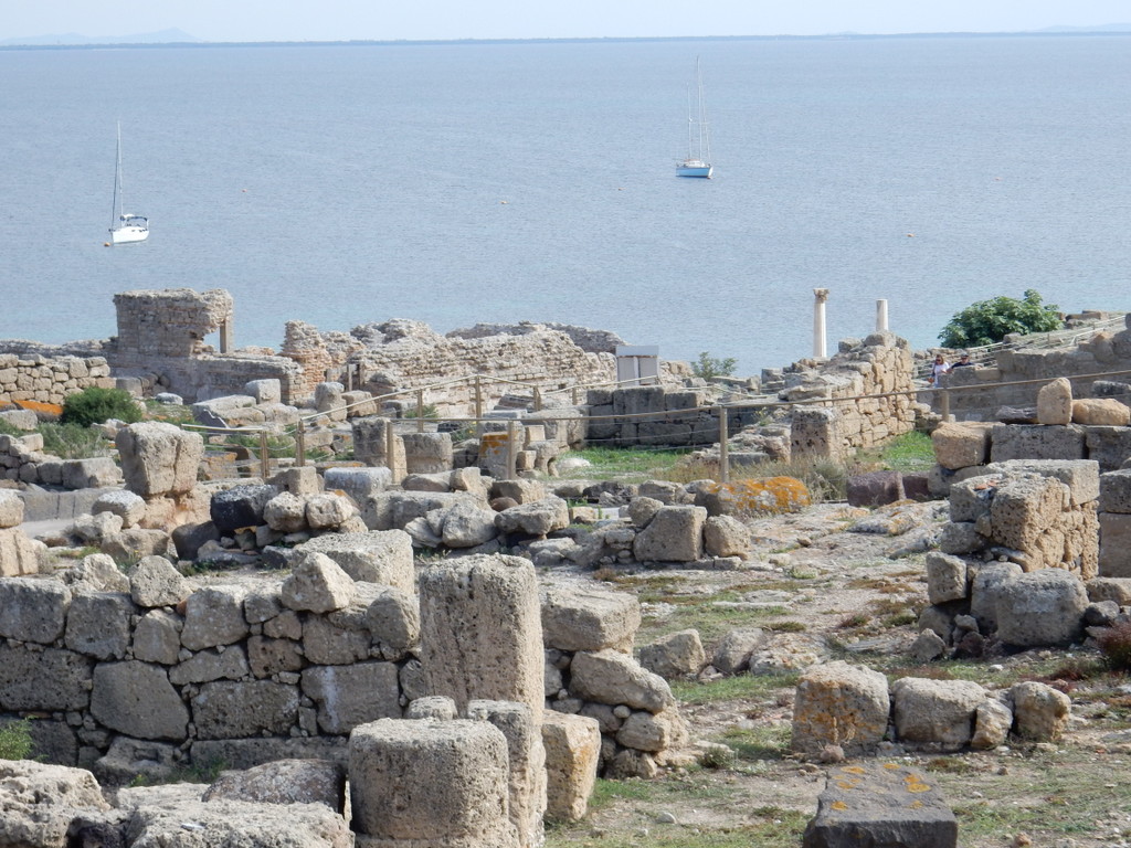
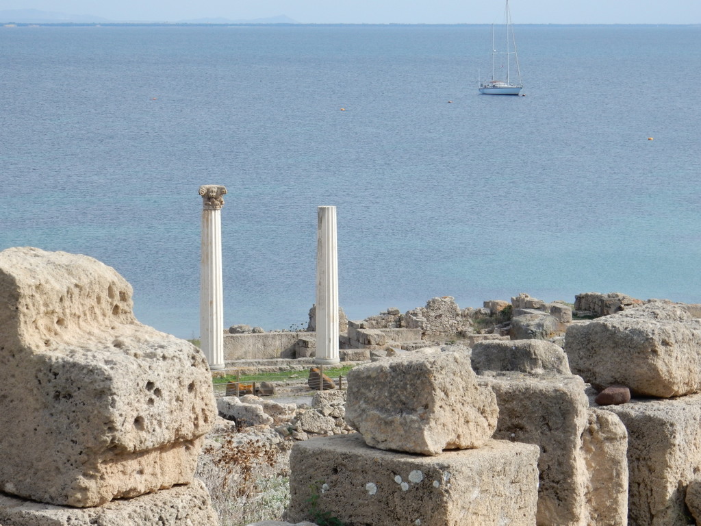
We spent five days in Bosa before sailing 29 nautical miles south to Oristano where we picked up a mooring in front of the ruins of the ancient city of Tharros on the Sinis peninsula.  Tharros was established by the Nuragic people of Sardinia in the Bronze Age and became an important Phoenician outpost in the 8th century BC.  It subsequently became a Punic (Carthage) city and a Roman city before being abandoned in the face of Saracen attacks in the early Christian period.

Ancient city of Tharros (Sabbatical III in background)

After one day in Oristano, on October 10 we sailed 45 nautical miles to Carloforte in ugly seas with large, steep waves from the northwest. We are still in Carloforte enjoying this town even more now that most of the tourists are gone.  We are spending a few hours every day doing the boat maintenance and repair required after a long sailing season that began in southern Turkey.

M.

Corsica: Santa’Manza, Bonifacio, and Lavezzi

View of the citadel at Bonifacio, Corsica (France)

We left Porto Vecchio, Corsica on September 19th and sailed south along the east coast before anchoring in the Golfe di Rondinara, a popular and very pretty and protected bay about 15 sailing miles away.  It was a beautiful sunny day with lots of wind.  Rondinara has lots of sea grass so there was not much room to drop anchor in sand, and even the sand that was available is thin and offers poor holding.  In the hours after we anchored, many other boats squeezed into the bay, often getting too close to boats that were already at anchor.  That made me nervous, particularly since a charter boat whacked Sabbatical III in Porto Pino by anchoring too close just one week before.  As it were, a large power yacht in front of us hit another power yacht while both were at anchor and swinging in the wind and they got entangled, leading to a lot of shouting and rushed activity.  As the offending yacht re-anchored alongside Sabbatical III, I stood on deck with my hands on my hips and stared at him just to let him know of my concerns.  Hopefully, my actions persuaded him to stay a few meters further from me than he otherwise would have.  Nonetheless, the crowd made us nervous all night and we left first thing in the morning.

I checked the charts looking for someplace less popular with lots of space even if it was not as well protected.  The large bay at Santa’Manza fit the bill perfectly.  It was wide open to the northeast quadrant but there was only one other vessel at anchor when we arrived, and he soon left, and we could tell that as long as we paid attention to wind direction and were willing to put up with some swell from the strong wind, we could anchor in peace and security.  Ashore, there was a beach bar that was only open on the weekend, and the small hamlet of Santa’Manza – so small that it lacked basics such as a bakery or any type of store, and bus service.  However, the small Hotel du Golfe was open along with the hotel restaurant.  What a gem it turned out to be.  We ate at the hotel restaurant every day and in the late afternoon sat on their patio overlooking the bay and drank Pastis while using their WiFi.  There was a beautiful walk along the north side of the bay with small sandy beaches interspersed with rocky shore.

The bay at Santa’Manza in southeastern Corsica where we anchored for five days
View of the citadel at Bonifacio, Corsica (France)

Our plan was to spend a couple of nights in Santa’Manza, waiting for the wind to settle down, and then sail around to the famous city of Bonifacio, set on the white chalk cliffs of the Bonifacio Strait, where we would have to stay in a pricey marina.  As we walked along the bay after lunch at the Hotel du Golfe on our first day, our waiter, Silvio, drove by and asked if we needed a ride.  He was going to Bonifacio.  So we hopped into his car and 15 minutes later we at the citadel of Bonifacio, a high promontory overlooking the Straits.  It is such an impressive place.  A walled city dating to the 9th century sitting on a narrow peninsular high over the Mediterranean. There is a very narrow fjord that cuts through sheer chalk cliffs and into the small port. While there we noticed that the marina was full, probably because boats were waiting for the wind to calm before heading out into the Bonafacio Strait, considered the windiest place in the Mediterranean.  Both Silvio and the proprietress of the Hotel du Golfe said that if we wanted a ride to Bonifacio from Santa’Manza on another day, we should just stand on the side of the road with our thumb out and a local would take us.  It was true.  Because of that we kept the boat at anchor in quiet Santa’Manza and hitched into Bonaficio.  There were only a few hours of uncomfortable roll at anchor during the five days we were there.

View of the cliffs east of Bonifacio at the southern tip of Corsica
The chalk cliffs at Bonifacio are not made of the most solid stuff
View of the cliffs east of Bonifacio at the southern tip of Corsica
We hiked a beautiful trail that runs on the edge of the cliffs east of Bonafacio
Every restaurant in Bonifacio offers the dish for which this place is famous – moules frites (mussels steamed in garlic and spices, served with fries)
Corsica’s most famous son, Napoleon Bonaparte, spent part of this early military career in Bonifacio

The wind calmed to nearly nothing so we decided to visit the uninhabited French island of Lavezzi  in the Bonifacio Strait, the southernmost part of Metropolitan France, on our way back to Sardinia.  It is a very pretty place but hard to enter and leave without local knowledge.  After a night at Lavezzi, we crossed the Bonifacio Strait to the “La Colba” anchorage on the south side of Capo Testa, Sardinia.  We will describe more of our trip back from Corsica in our next blog entry.

M.

The anchorage at Lavezzi Island was small and strewn with rocks above and below the water and is mostly uncharted. We grabbed the mooring of a tour boat just as they left for the day.
Lavezzi Island is uninhabited. We came ashore in the dinghy and walked around.
Lavezzi is famous in France as the site of one of its greatest naval disasters. The frigate Sémillante, heading for the Crimean War in 1855 with almost 700 on board, was lost with all hands when caught in a storm and driven into the rocks. A cemetery was created on the island for the bodies and a pyramid of boulders was constructed as a remembrance. This cross on one side of the cemetery is constructed from the ships timbers. Only the Chaplain and Captain have marked graves.
Grave of the Chaplain of the Sémillante.
Boulders at Cala Giunco, Lavezzi Island.
Lighthouse of Lavezzi Island warns vessels away from its dangerous rocky shore. It did not do me any good. As we departed, I hit an uncharted underwater rock at slow speed that put a small dent in my keel.